

Trip Log: Antarctica
Life on the Frozen Continent

Many have asked what the day-to-day is actually like when visiting Antarctica, so I thought I’d share slices from my field notes alongside some commentary for added insight into my experience. It’s insane that I’m even writing this, especially since I wasn’t even done digesting the experience of my first expedition to the continent before embarking on this one. Anyways, here we go!
Chapter 1 - Arrival & The Drake
Mar 19:
I begin the grueling journey to Ushuaia, Argentina. Known as ‘Fin del Mondo,’ or ‘End of the World,’ a fitting name as Ushuaia is considered to be the southernmost city on Earth - the closest city and main port of entry to Antarctica.
It was grueling, as I had 3 layovers ahead of me, each one several hours long. To top it off, I’d spent the last week in customer service hell as three different airlines tried to sort out my return flight, which was still unconfirmed. While I didn’t know what the return journey looked like, departure went like this:
ATL > SCL > AEP > USH
Mar 20:
2300hrs - I escape from airport hell with my feet in Ushuaia. Just enough time for me to stop by a bar for a quick pint before getting some much-needed rest before embarkation.
Mar 21:
Ushuaia, Embarkation day. Low of 2c, low winds.
1000hrs - I dragged my check-in luggage to downtown Ushuaia, at a designated bag drop off point. The Port of Ushuaia restricts passengers from lugging their own check-in luggage to the ship. They get tossed onto a truck, brought to our ship, then placed in our cabins for us.
Embarkation wasn’t until noon, so I walked around Ushuaia, chatting with fellow eager passengers on my way to grabbing a quick pre-departure meal.
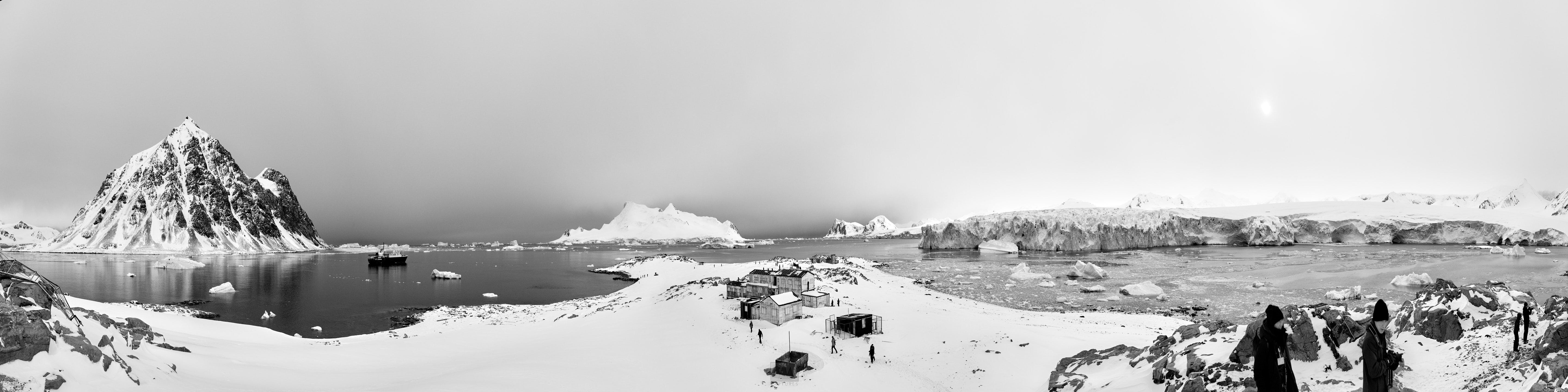
1200hrs - I walked over to the ship, docked near the end of the port. Apparently, it costs about $20,000/day to dock at the Port of Ushuaia.
The ship crosses the Drake Passage, sails through the Beagle Channel, docks in Ushuaia, disembarks all passengers, resupplies its food/water/fuel/waste, and takes on a new group of passengers before sailing back across the Drake within a span of 24hrs, to avoid paying for an extra day at dock. Insane stuff.
Speaking of the ship, let’s talk a little about it.
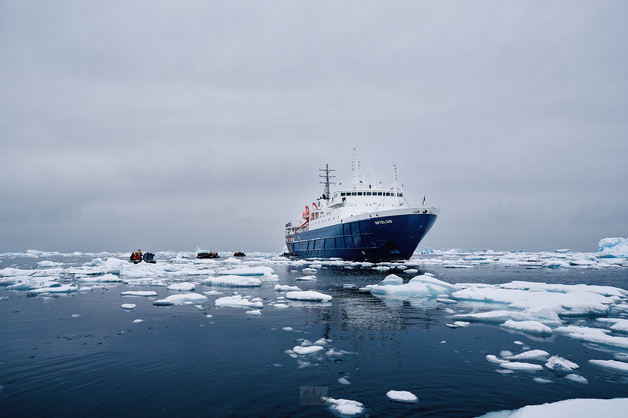
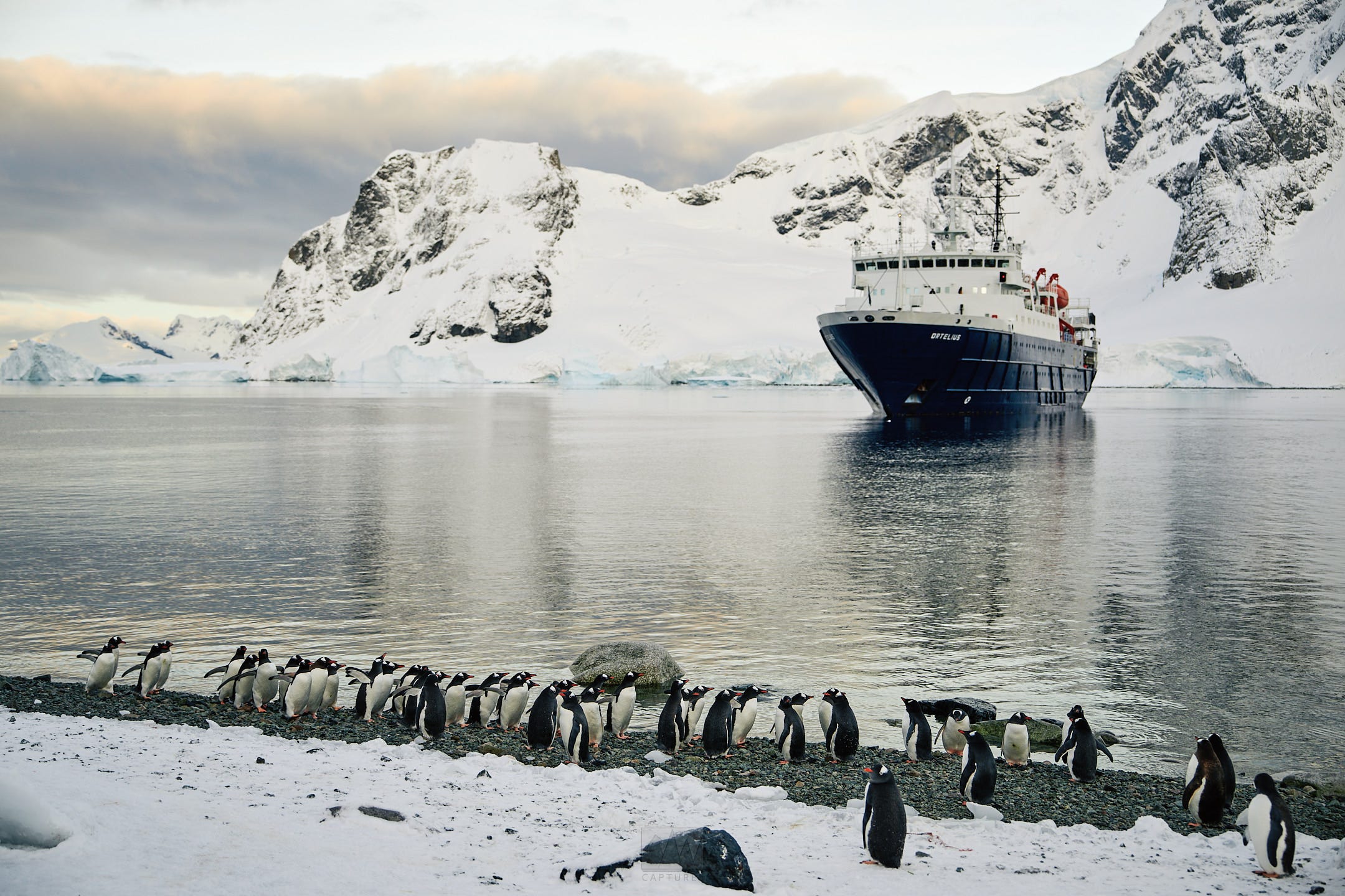
Built in 1989 in Gdynia, Poland, m/v Ortelius was originally named the Marina Svetaeva - a specially built research vessel for the Russian Academy of Science. It was purchased, renovated, and renamed Ortelius, after the Dutch/Flemish cartographer, Abraham Ortelius (1527-1598), by Oceanwide Expeditions.
Its 91m long, with a beam of 17m , a draft of 5.4m, and 7 decks. It also comes equipped with a large helideck, big enough for two helicopters (we didn’t have helicopters with us on this expedition).
It holds 108 passengers across 50 cabins, with room for 40 crew and 10 expedition guides. This expedition, we had about 106 passengers, 9 expedition guides, 1 ship doctor, and 41 crew members assisting in the engine room, hospitality, dining and of course, the bridge.
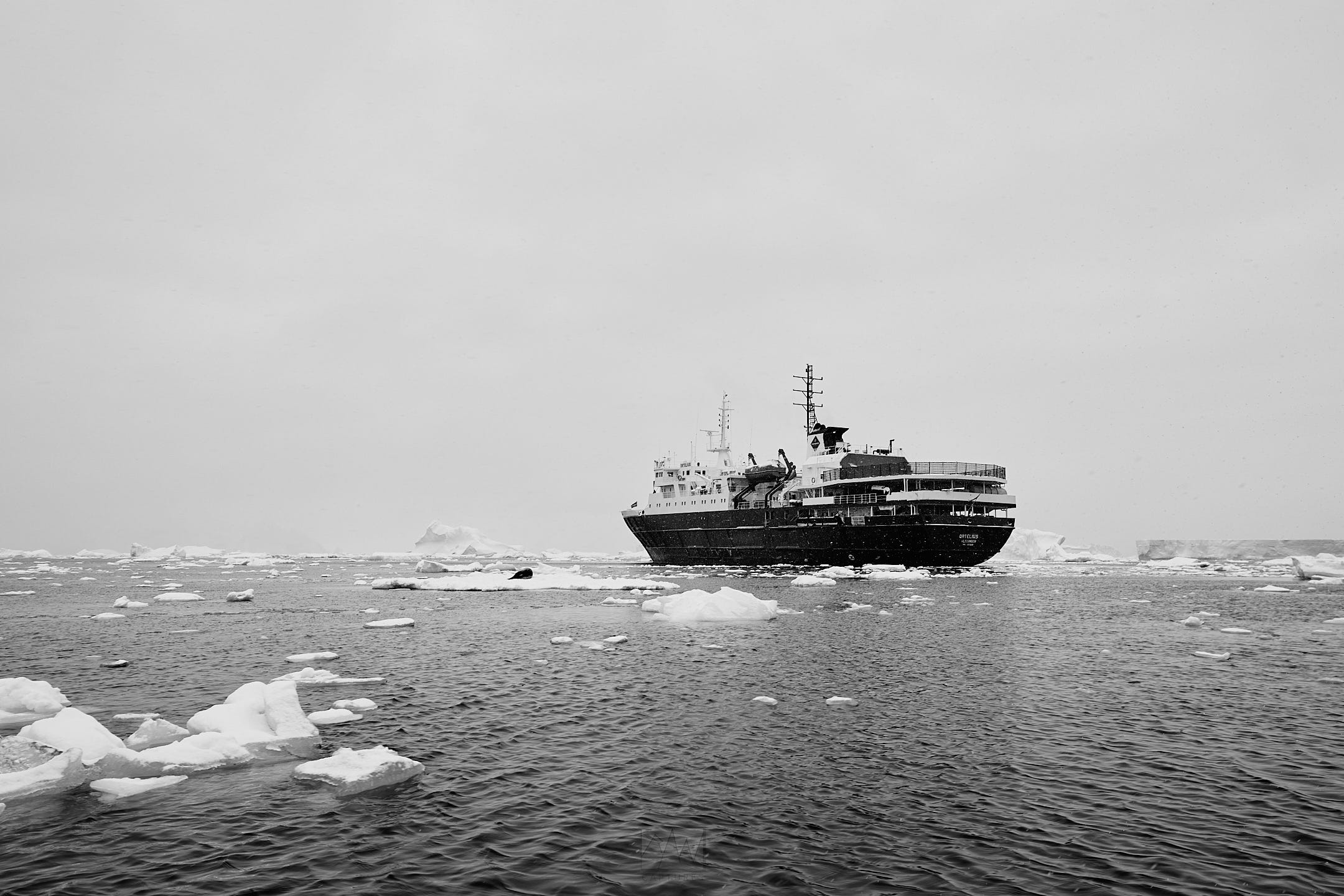
Ortelius is a class UL1/A1 ice breaker, capable of withstanding just about any iceberg that would come our way, so there’d be no repeats of the Titanic here.
As I head up the gangway, we’re handed key cards which we’ll use to check ourselves in and out of the ship between landings, as well as open the doors to our rooms. I was then shown to my room where I’d meet my roommate, a hilarious Swedish man who was traveling with three other friends who turned out to be Singaporeans! Luckily, it was just the two of us in that one room.
(For those who don’t know, I was born and raised in Singapore)
We get a quick tour of the ship, as well as a safety briefing before having our first dinner onboard. After dinner, I stayed out on deck to enjoy a view of the Beagle Channel, where we had some quick sightings of harbour porpoises.
2230hrs - we exited the Beagle and entered the infamous Drake Passage.
Mar 22:
The Drake Passage, Day 1. Low of -1c, swell @ 4m, 5kt winds.
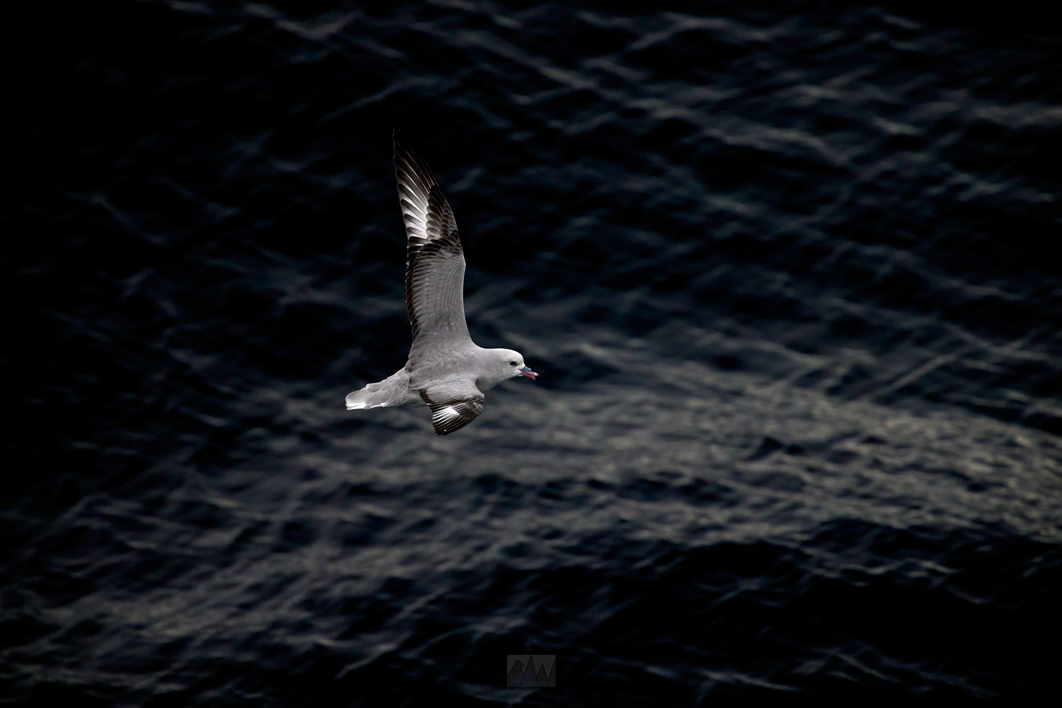
After breakfast, which happens in the form of a typical hotel-style continental breakfast, we were accompanied by multiple seabirds who were leveraging the ship’s draft to aid in their flight.
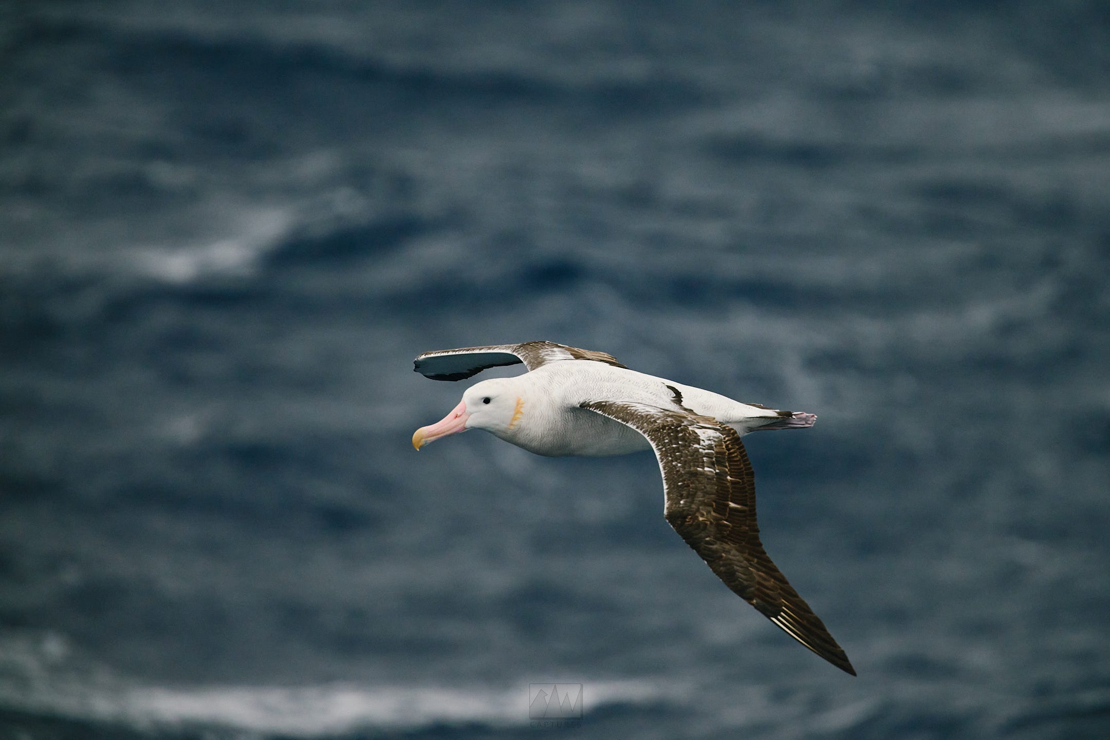
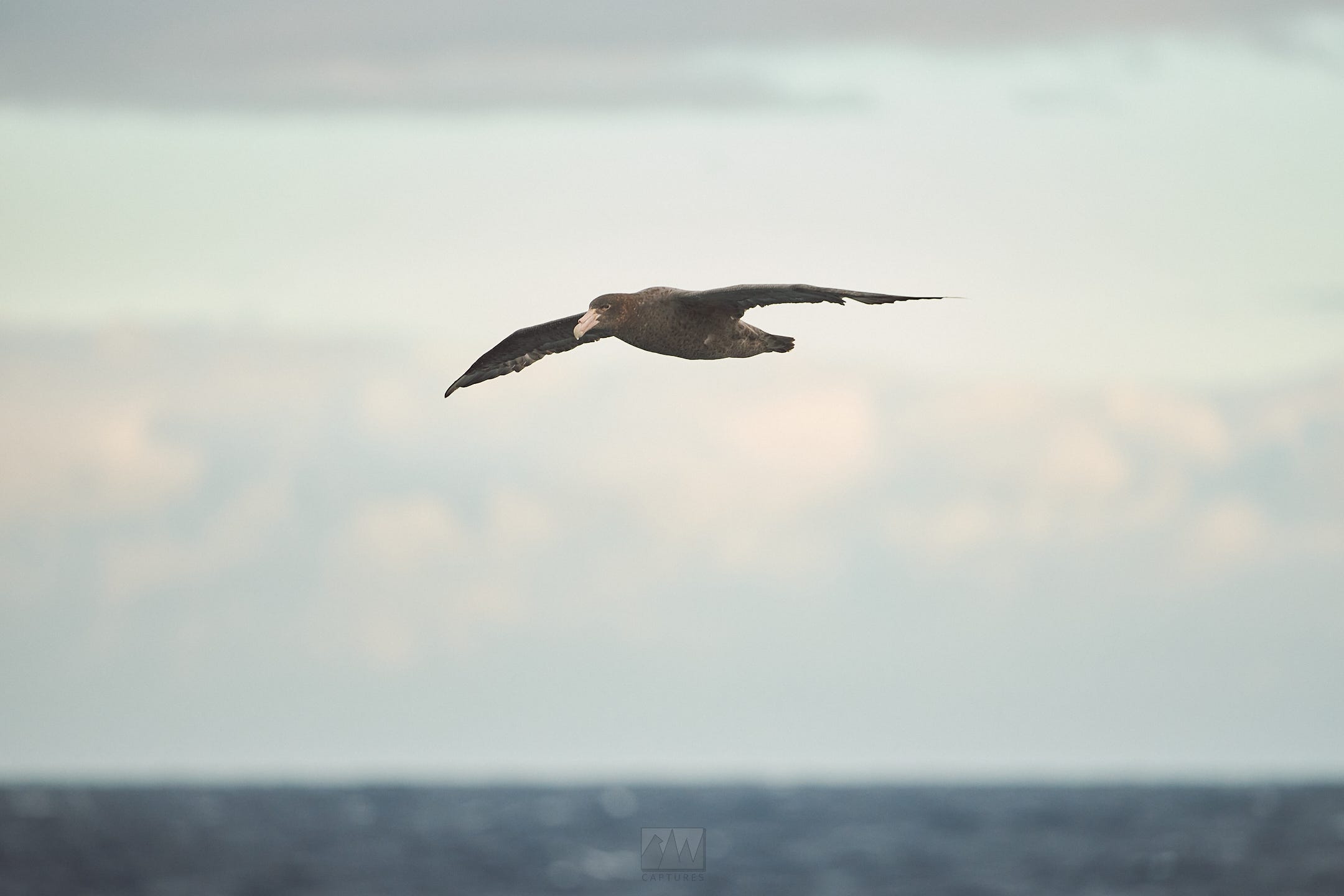
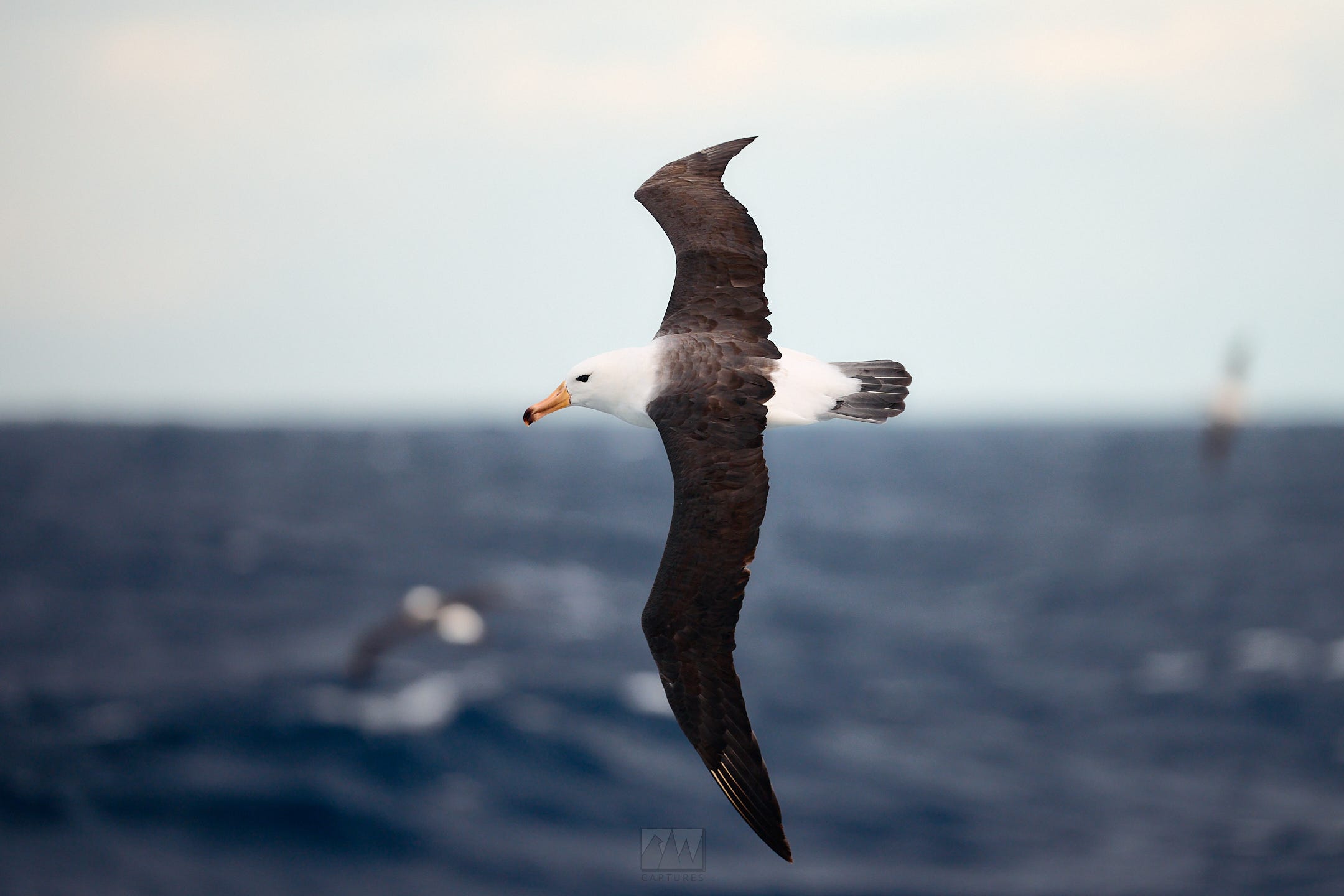
Two of the birds that joined us were the Wandering and Royal Albatrosses, two birds that regularly fight it out for the largest wingspan of any living bird species. They regularly have wingspans of up to 4 meters, or 13 ft. Though I’m not a very tall person, that’s still over two times my height.
In the afternoon, we had a few presentations from the expedition staff, who had prepared talks about Antarctica’s history, wildlife, and geology.
Throughout the day, the weather got worse, though not by much. Without the safety of the Beagle Channel, we were now experiencing an “average” day on the Drake. Luckily, I seem to be unfazed by motion sickness out in the real world. As the ship was thrown about by the relentless waves, we sailed on.
Mar 23:
The Drake Passage, Day 2. Low of -5c, swell @ 3m, 10kt winds.
0715 - wake up. Breakfast, presentation, lunch.
After lunch, we were briefed on biosecurity measures we had to take prior to our arrival on the continent. We’re not just visiting any old place. This is Antarctica - the one place on Earth that has yet to see any major interference from humans, Earth’s last true pristine wilderness. Plus, with avian flu running rampant across bird colonies worldwide, but most significantly in Antarctica and the sub-Antarctic islands, extra precautions must be taken.
All items we’d wear and bring onto land needed to be picked entirely clean - not a single speck of dust, lint, or any foreign material was allowed to remain on items we’d bring ashore. This prevents us from accidentally introducing foreign seeds, bugs, or microbes into Antarctica, which we want to remain pristine and untouched.
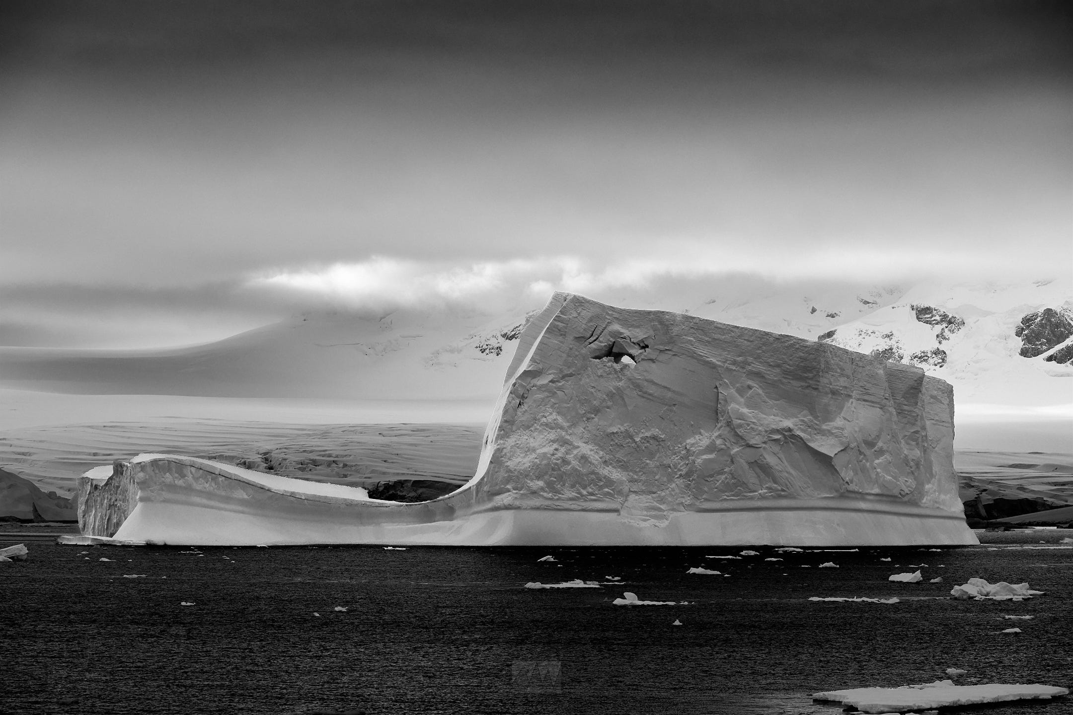
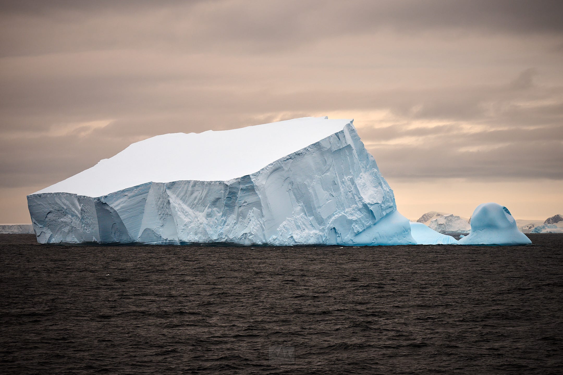
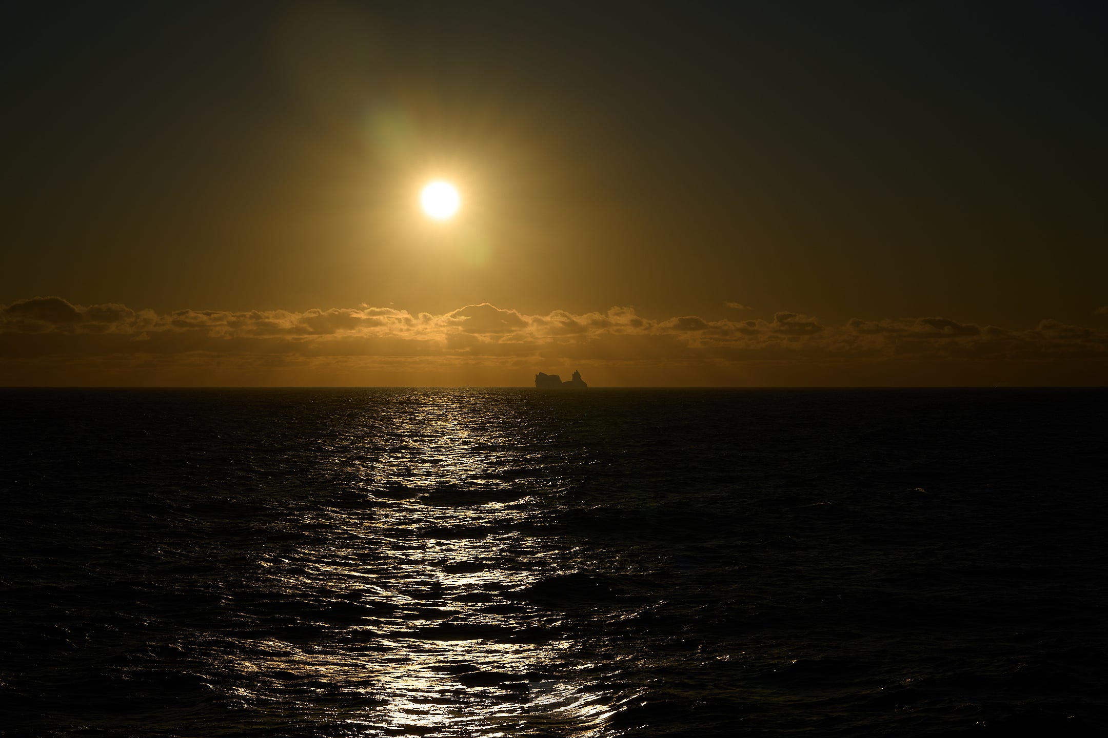
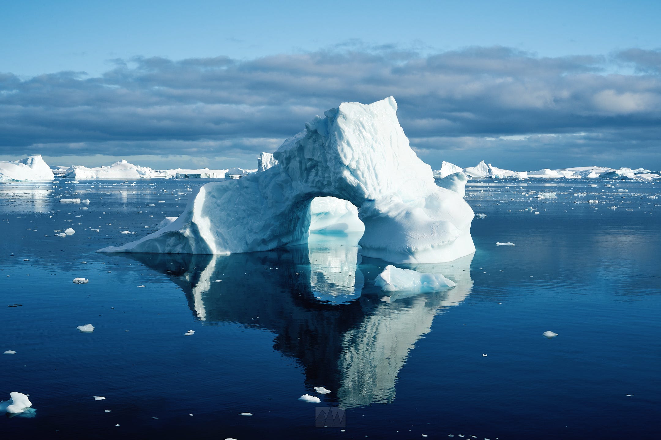
1600hrs, @ -62S, -64W - our first iceberg. Easily larger than our ship, we steered clear of it, allowing us a great view of this behemoth. As it’s often the case with me, I was too awe-struck to even think about picking up my camera for a photo.
Dinner followed, and after that, the documentary “Endurance” played in the lounge.
CHAPTER 2 - The Frozen Continent, Southbound.
Mar 24:
Fish Islands & Prospect Point. Low of -1c, calm seas, 5kt winds.
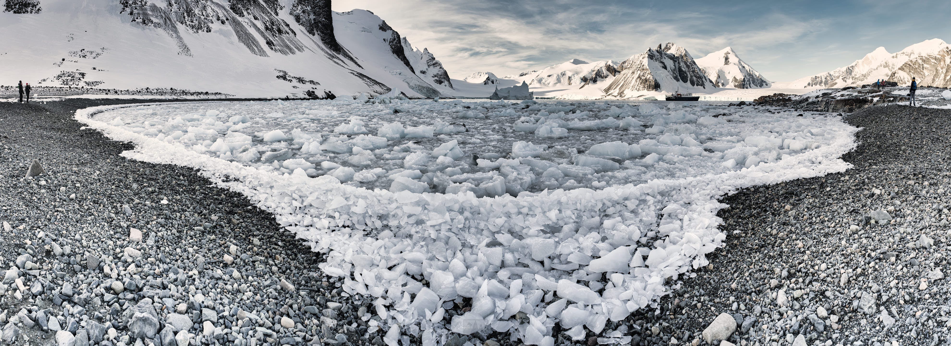
Unlike most other expeditions to Antarctica, we skipped most of the Northern half of the peninsula in search of uncharted waters and to test our luck, seeing just how far south we could go. As we sailed south, we eventually came across the Fish Islands, discovered and named by the 1934 British Graham Land Expedition.
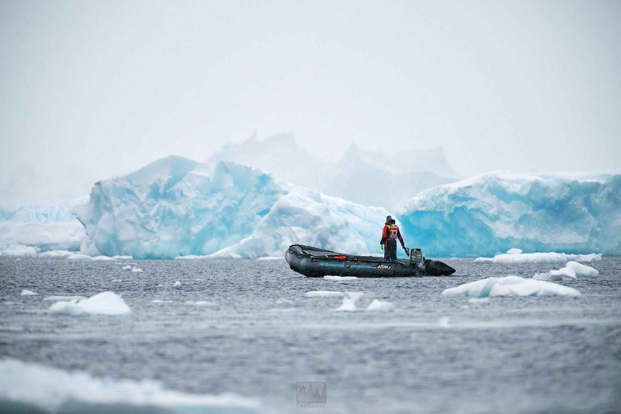
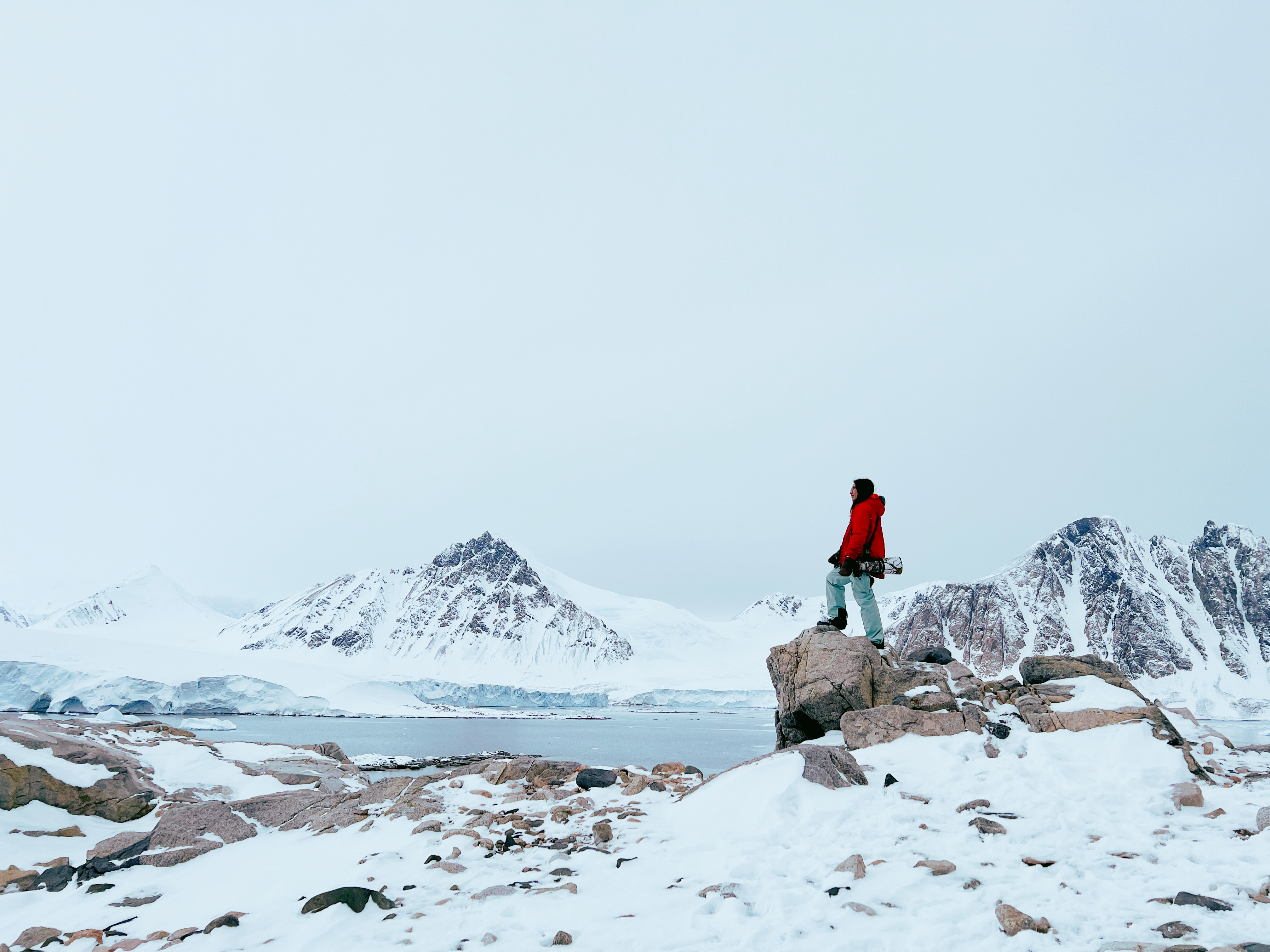
After breakfast, we would have to suit up for our first outing on the continent in the form of a Zodiac cruise through the Fish Islands.
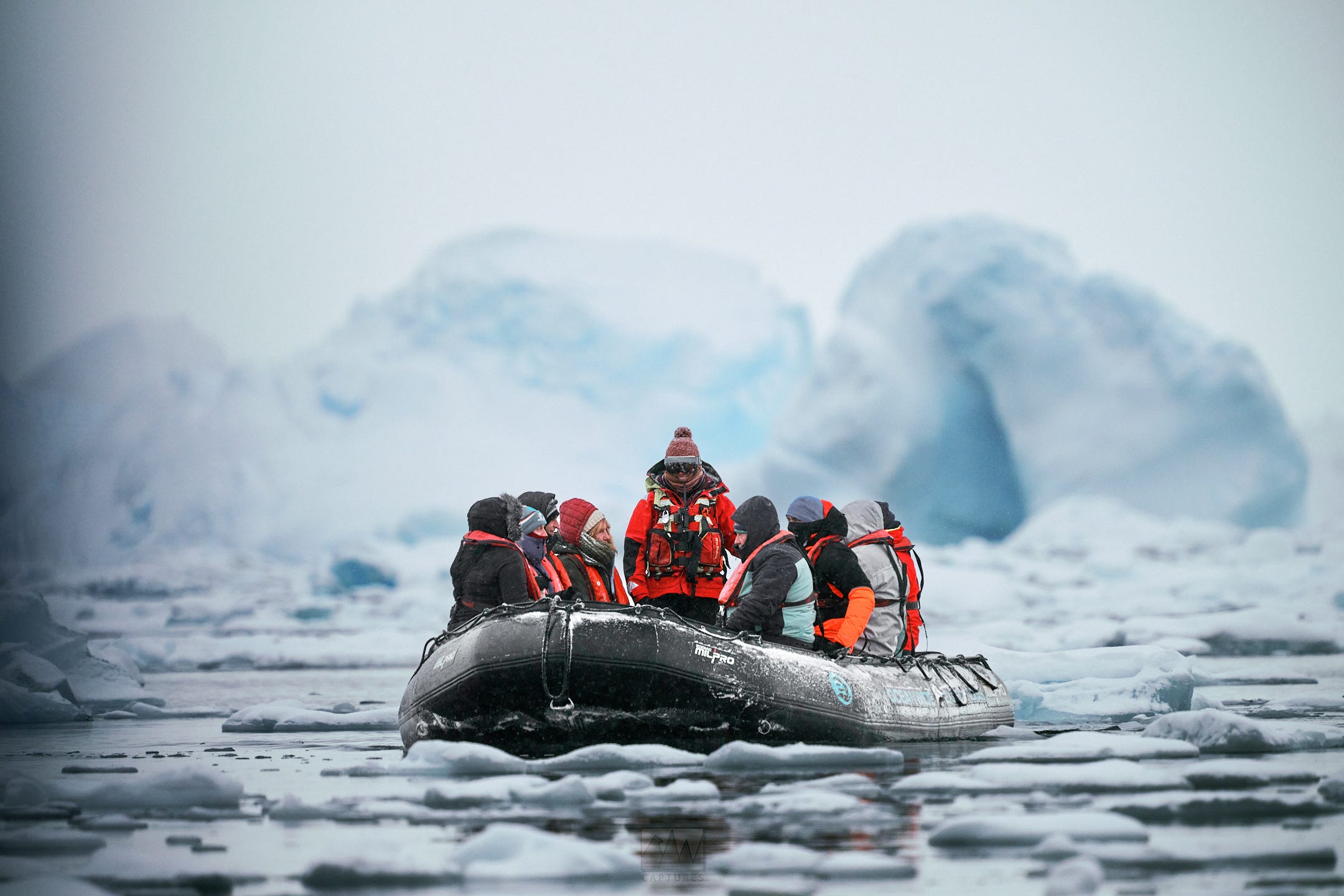
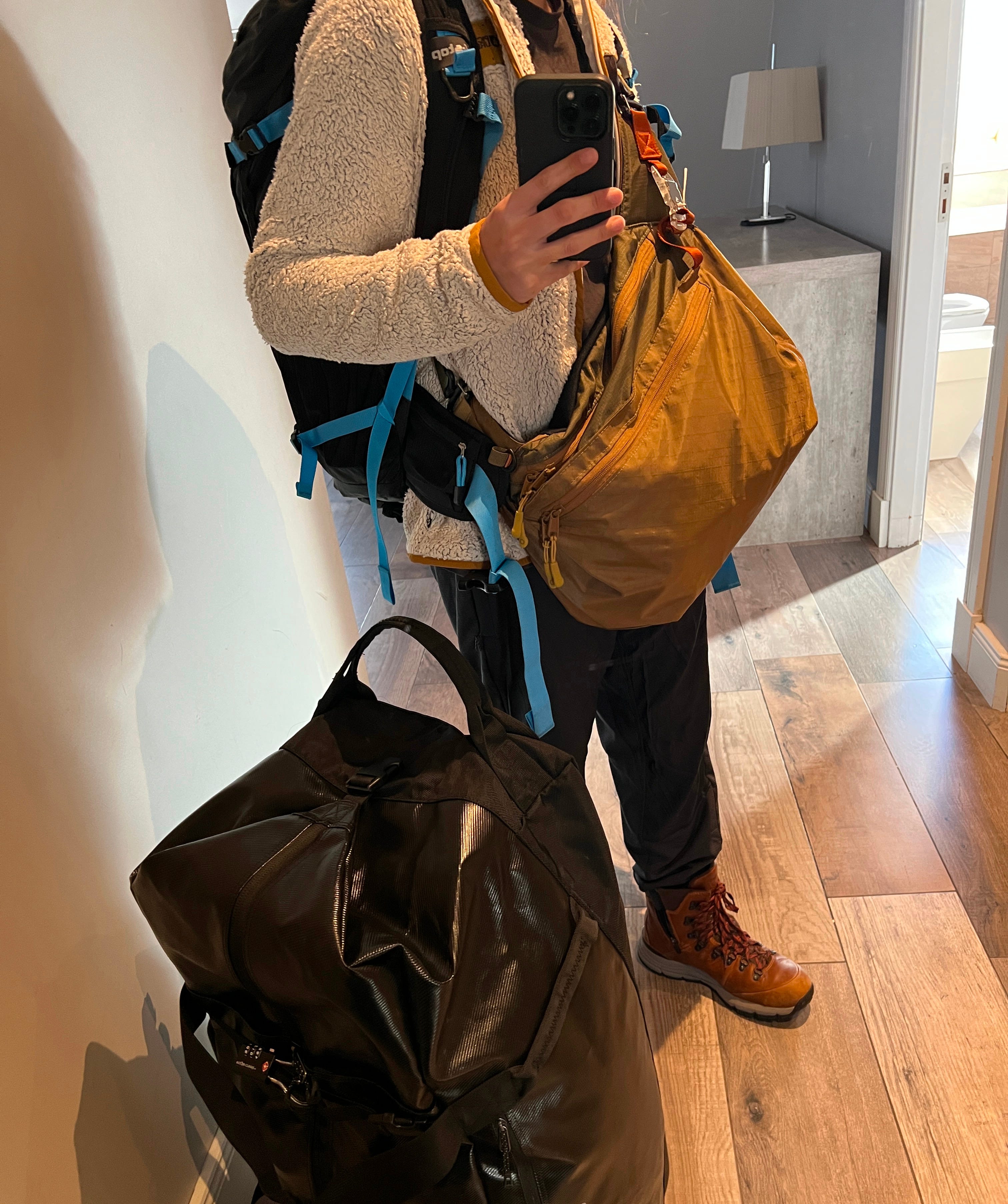
Zodiacs are smaller, ~12 passenger single-engine inflatable boats that ferry us around, through sea ice and ice bergs too cumbersome for the larger Ortelius to navigate through. “Suiting up” involves wearing every layer you packed with you - conditions can and do change rapidly in Antarctica, so preparing to stay warm in -40c weather is always a must.
Additionally, the possibility of getting stranded is extremely high as winter starts. If the sea ice forms or icebergs move too quickly, not even the Zodiacs would be able to get us back to the ship, meaning we’d have to reenact the stories of explorers past and prepare to spend a night, or thirty, on land. Luckily, this never happened as weather was unbelievably good the whole trip.
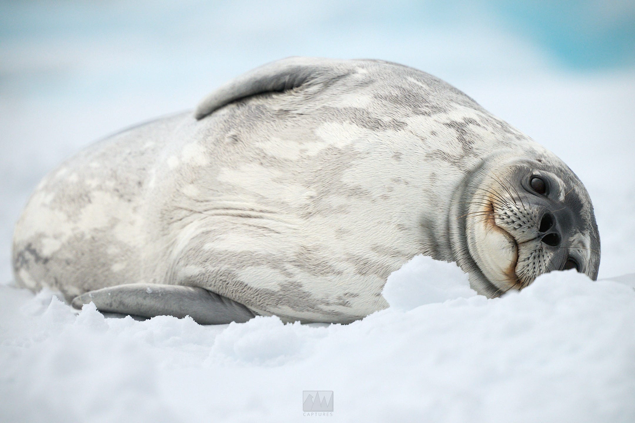
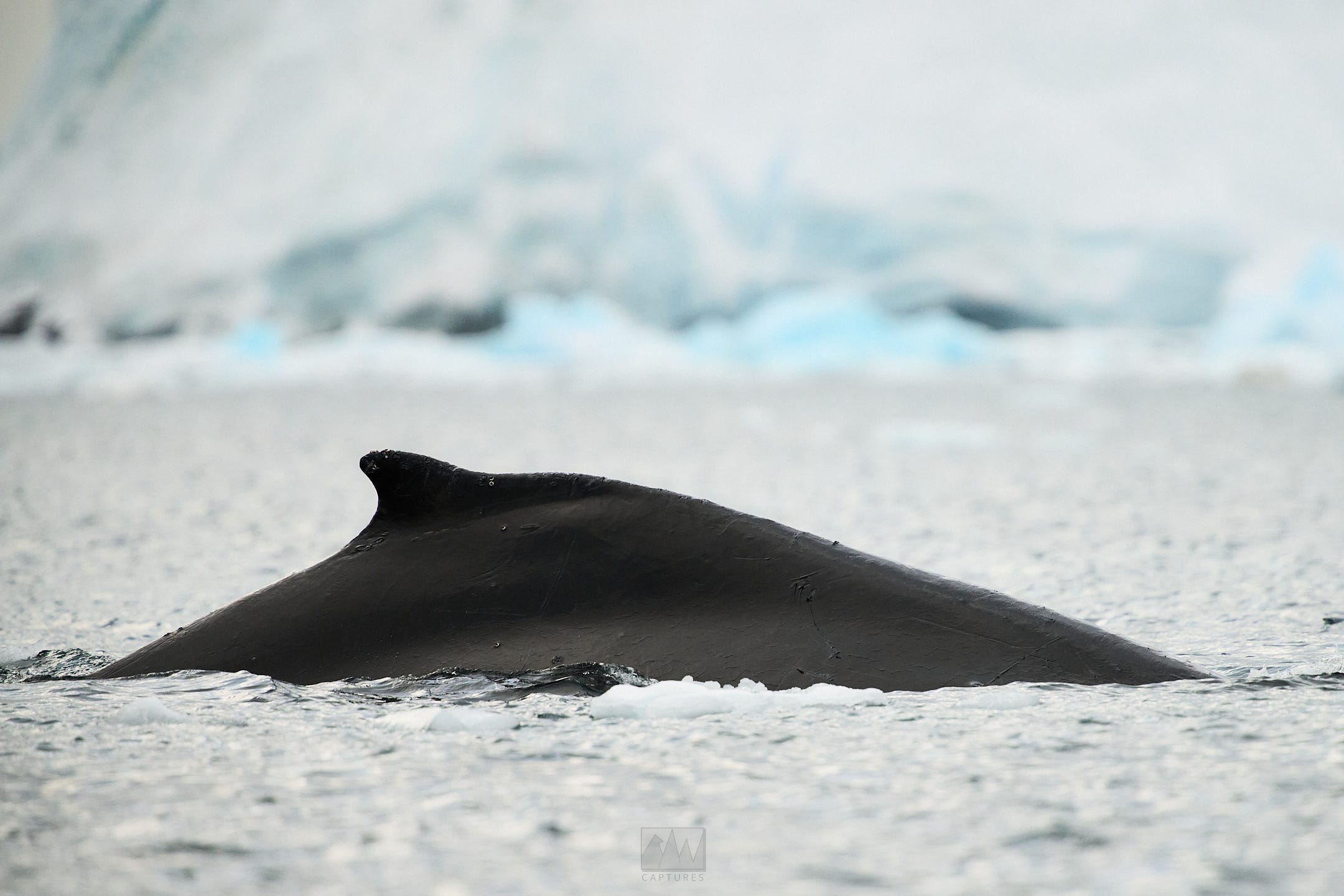
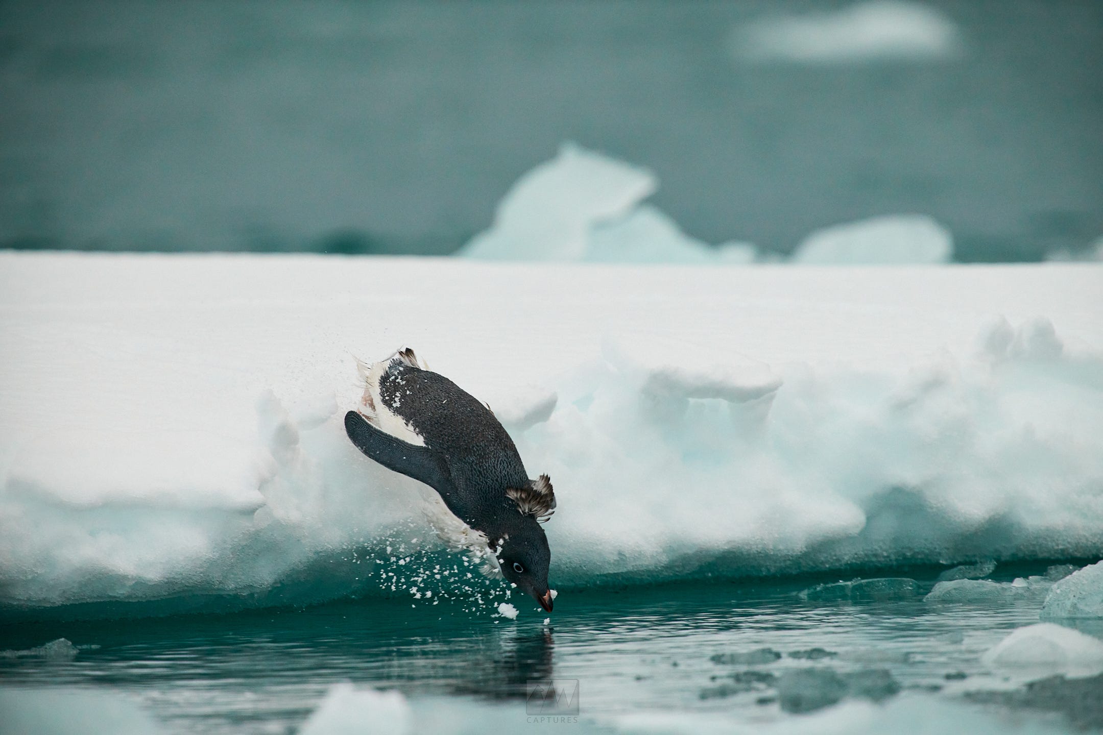
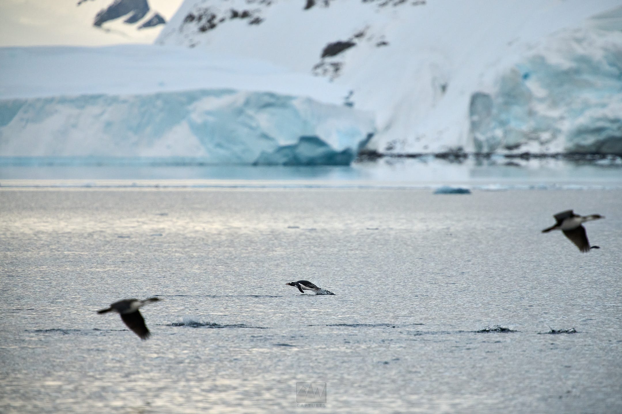
Our first outing was a “cruise-only.” With the Zodiacs, we sailed through the Fish Islands, coming across multiple humpback whales, Weddell seals, Antarctic shags, and massive Adélie penguin colonies.
(Each outing is about 4hrs long regardless of the type of outing)
We returned and had lunch while the ship sailed further south, towards Prospect Point, where we’d do a split landing (half of us do a Zodiac cruise first, the other half land on the continent first). I was on the half that would cruise around first, then make land.
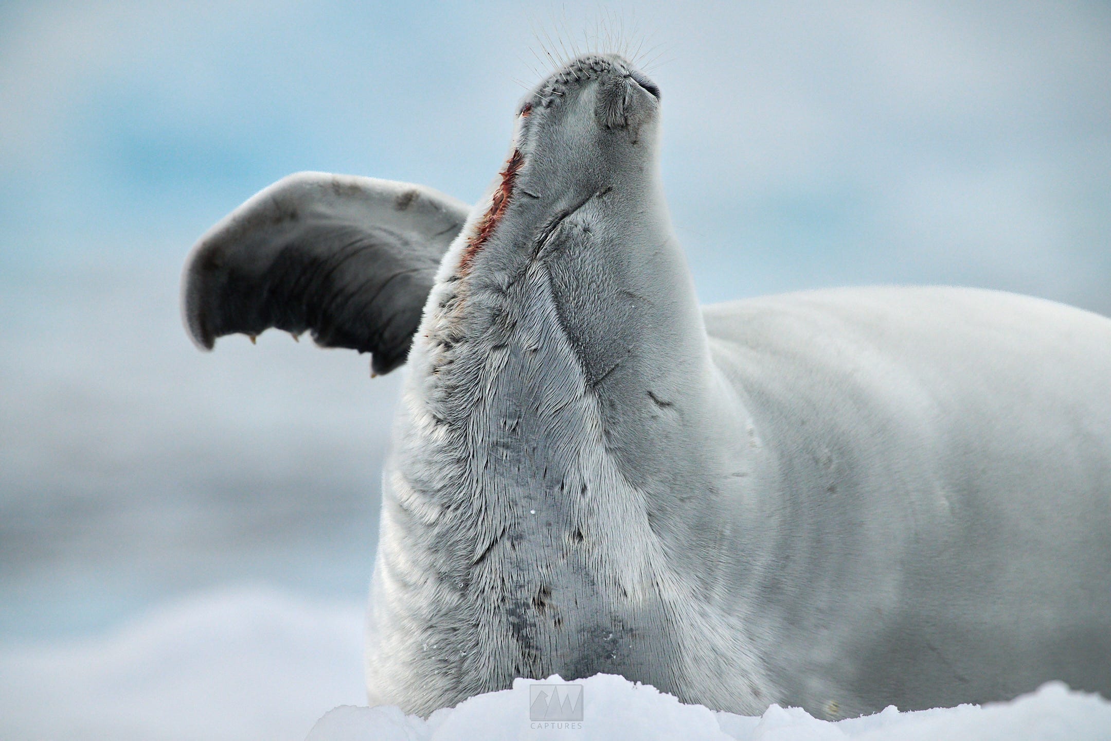
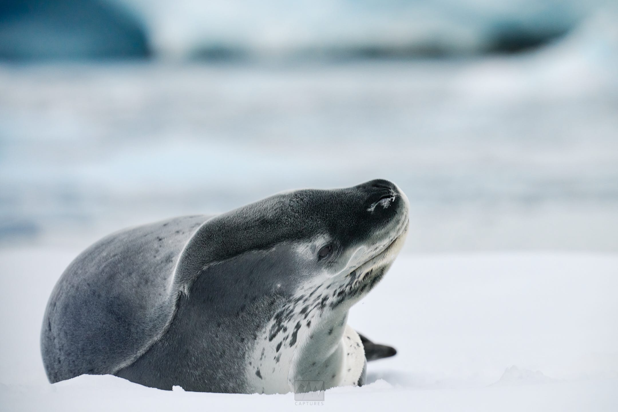
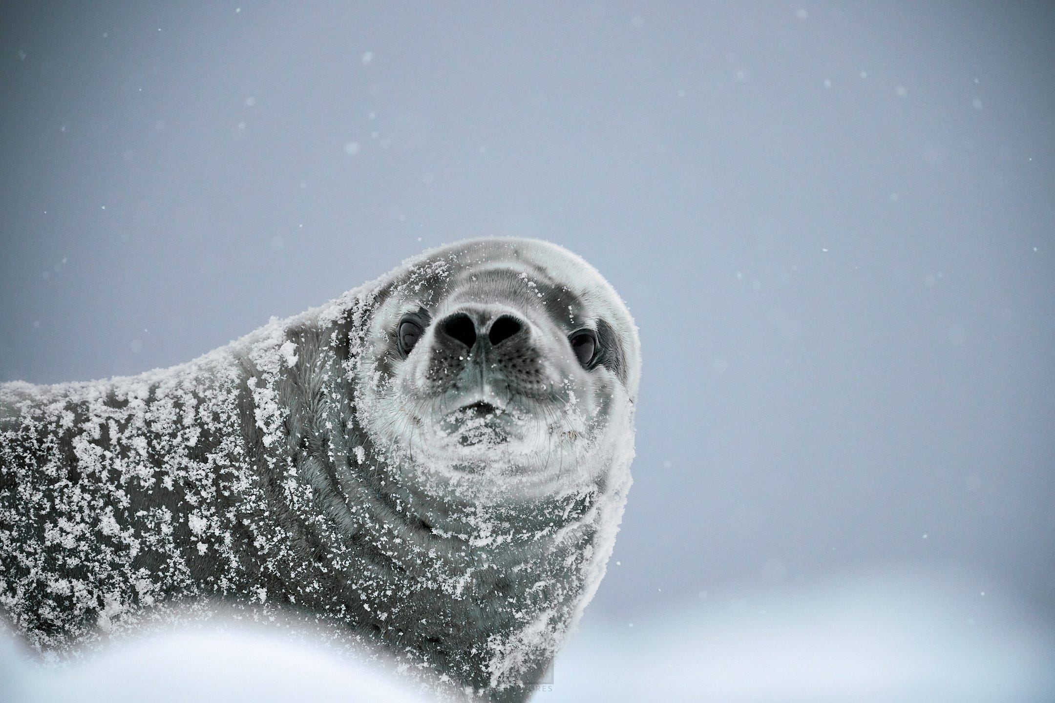
Prospect Point was the site of the British research station, creatively named “Station J.” The station was abandoned in 1959, and finally removed in 2004. Now, it’s a small landing site and home to thousands of Adelie penguins and to some smaller, remotely controlled research instrumentation. On the cruise, we encountered several crab eater seals, as well as one of the largest leopard seals I’ve ever seen.
Return. Dinner. Presentations.
We crossed the Antarctic Circle, -66,33S at about 2330hrs.
Mar 25:
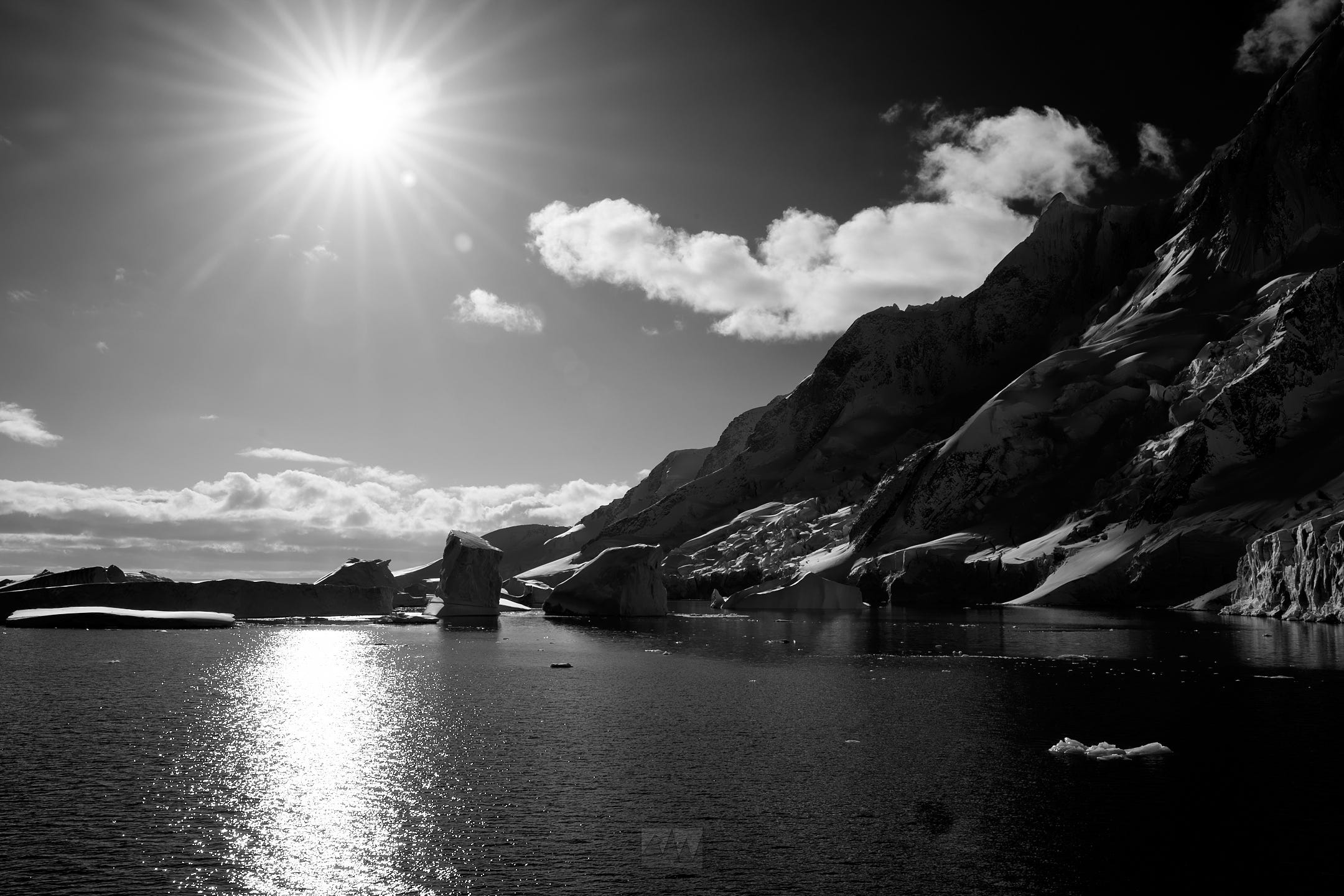
The Gullet, Pourquoi-Pas Island, Marguerite Bay. High of 5c, low of -7c, slightly rough seas, 15kt winds.
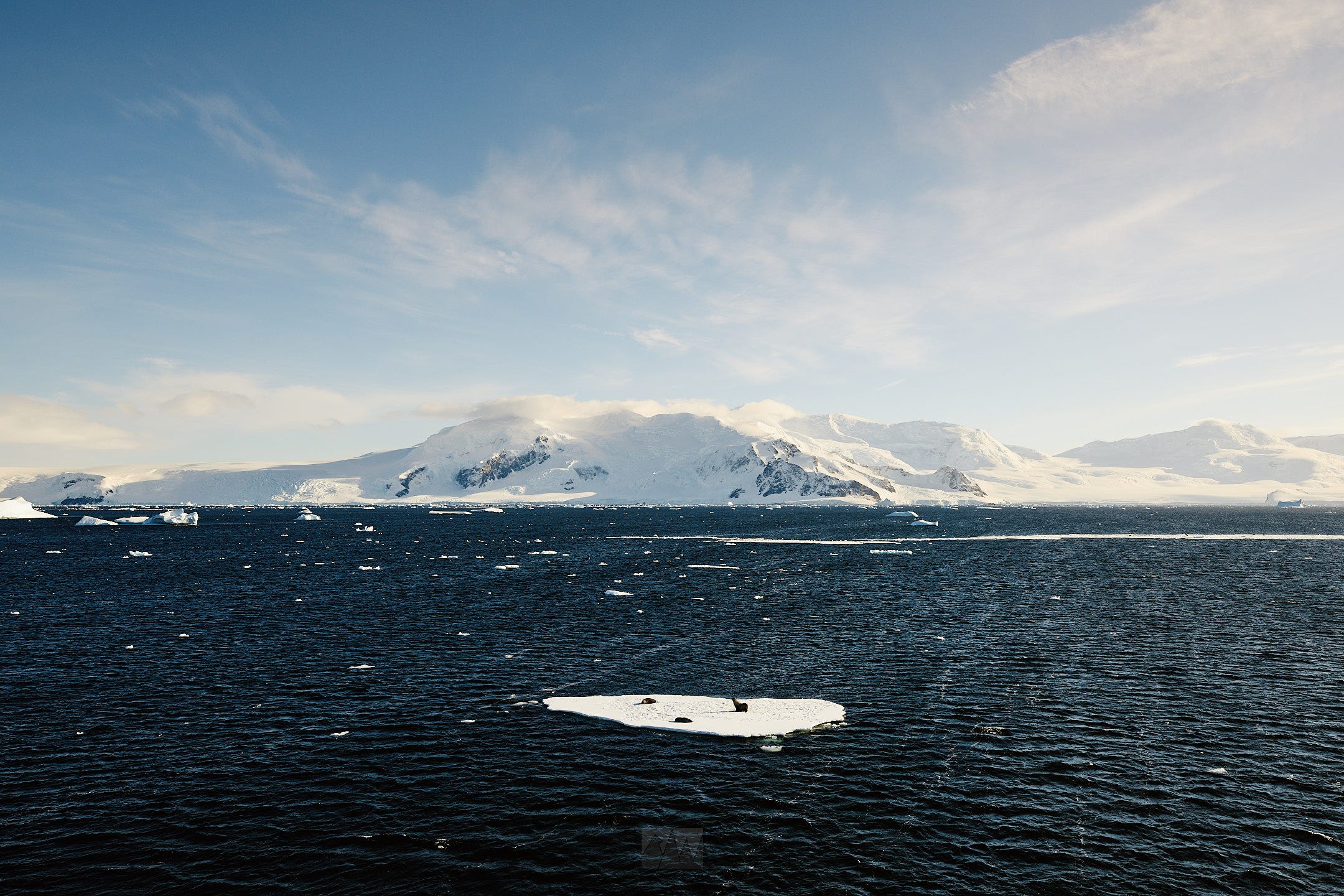
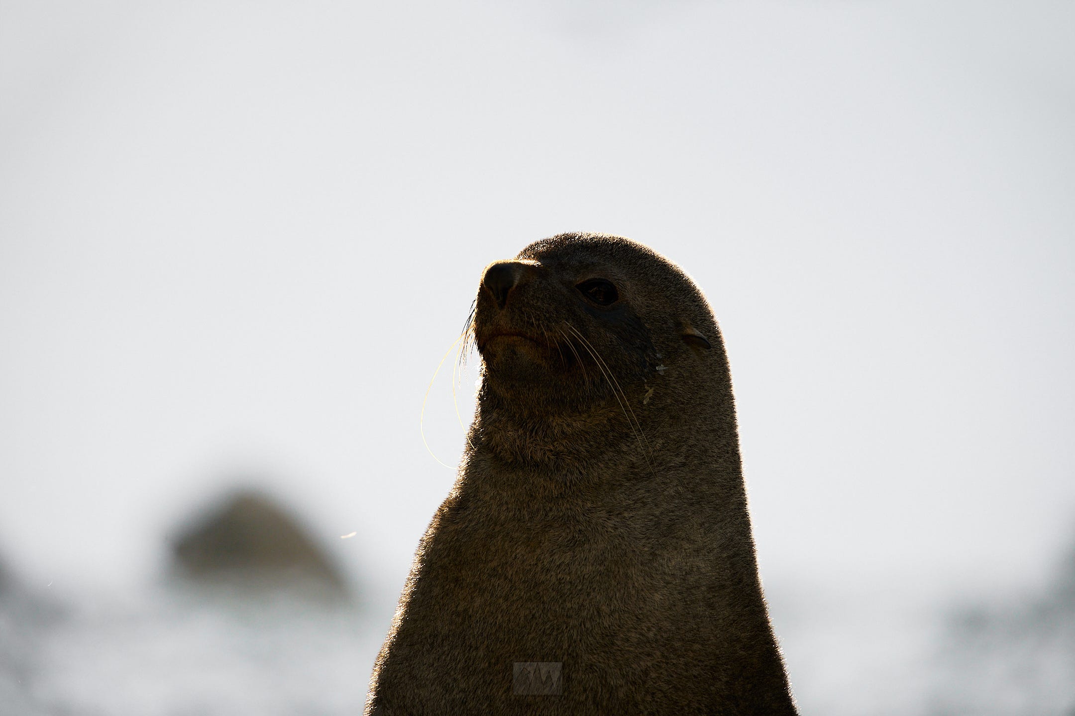
We spent the morning sailing through The Gullet, a narrow channel between Adelaide Island and Graham Land, dodging massive icebergs along the way. From the ship, many fur seals, Adelie penguins, and whales could be spotted, though they were all quite a distance away.
Presentation, Lunch.
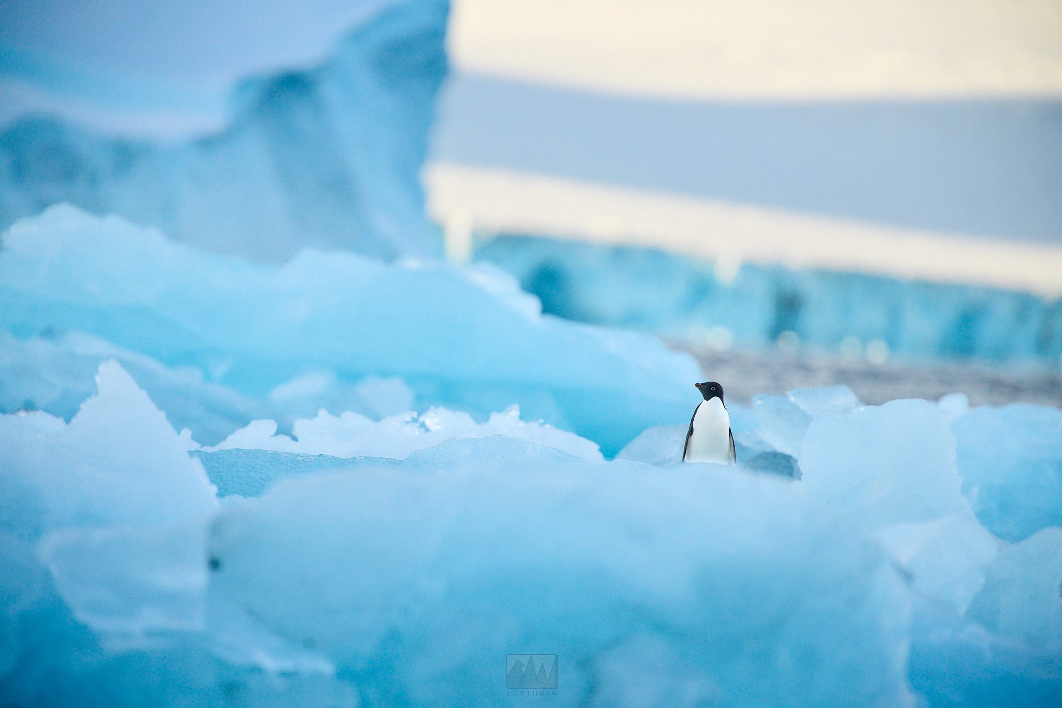
After lunch, we’d successfully navigated to Pourquoi-Pas Island. It was named during the British Graham Land Expedition, after Jean-Baptiste Charcot’s ship, the Pourquoi-Pas. We would step foot on the continent for a second time here, where we encountered tens of dozens of fur seals, Adélie penguin colonies, as well as more Antarctic shags, which usually don’t appear this far south.
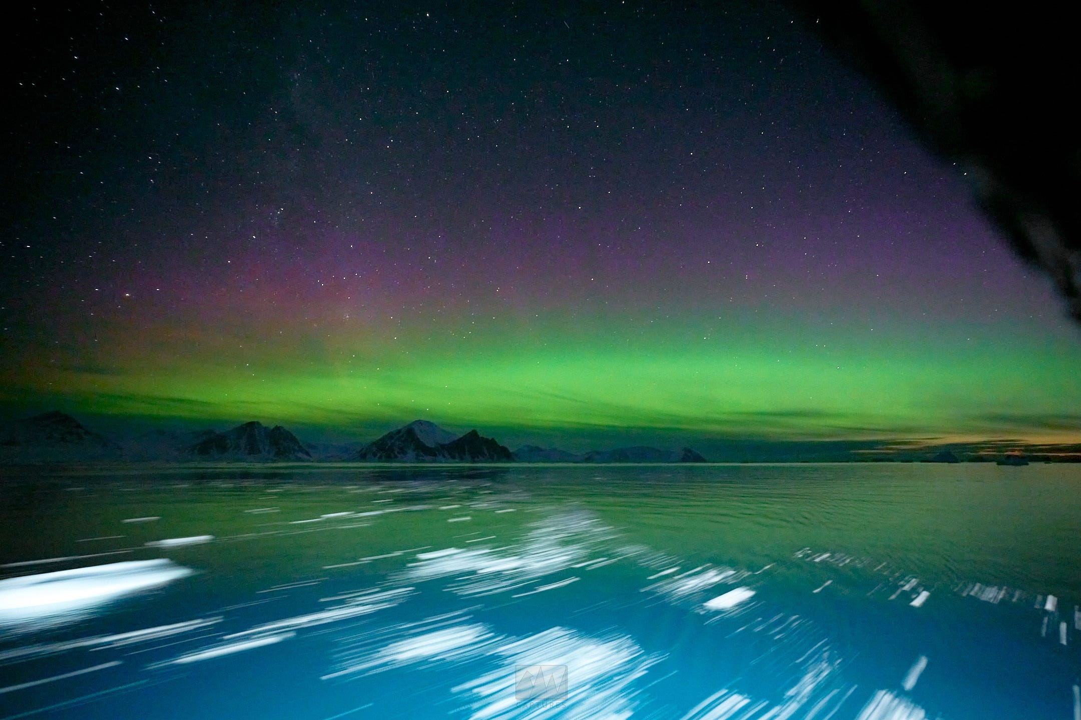
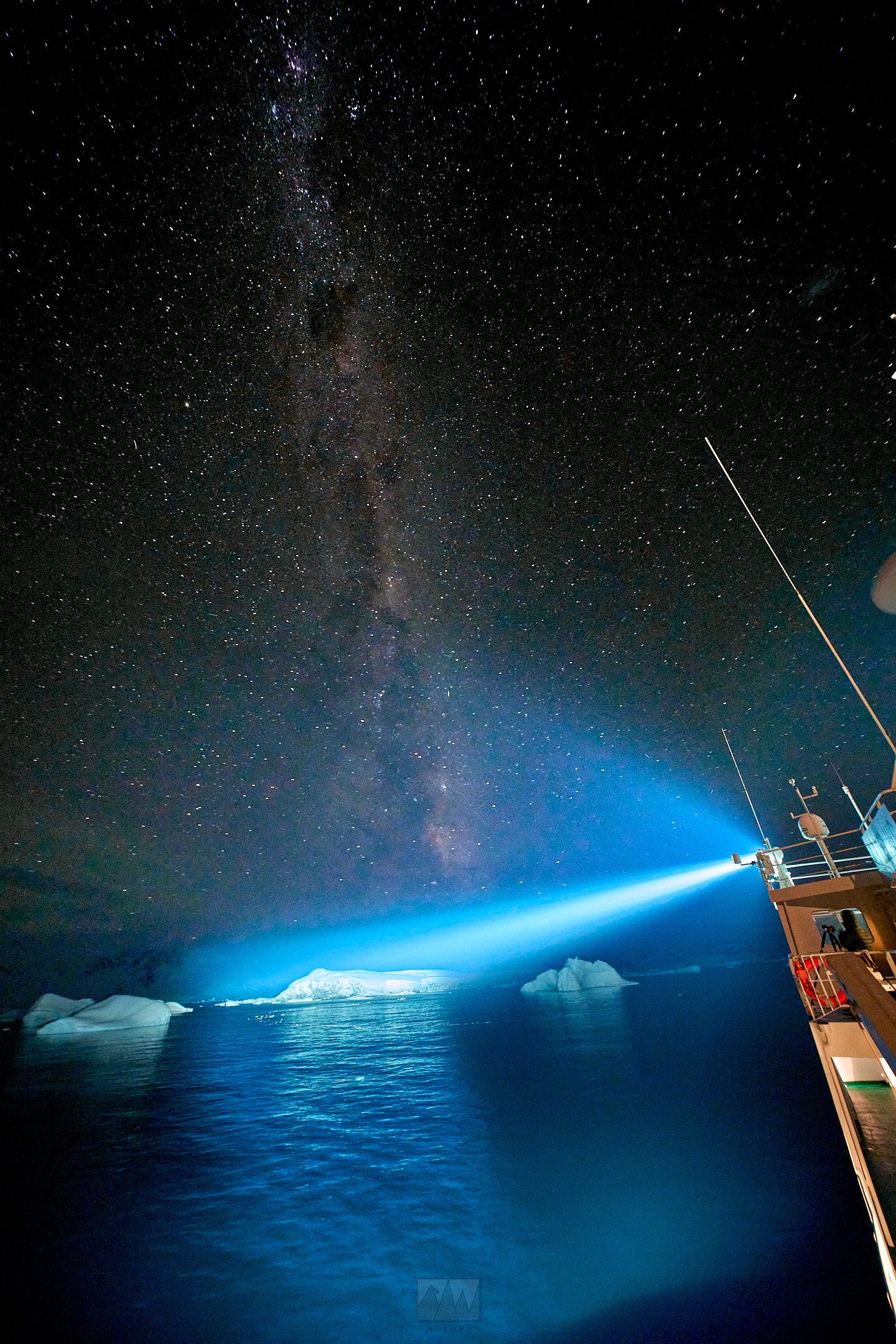
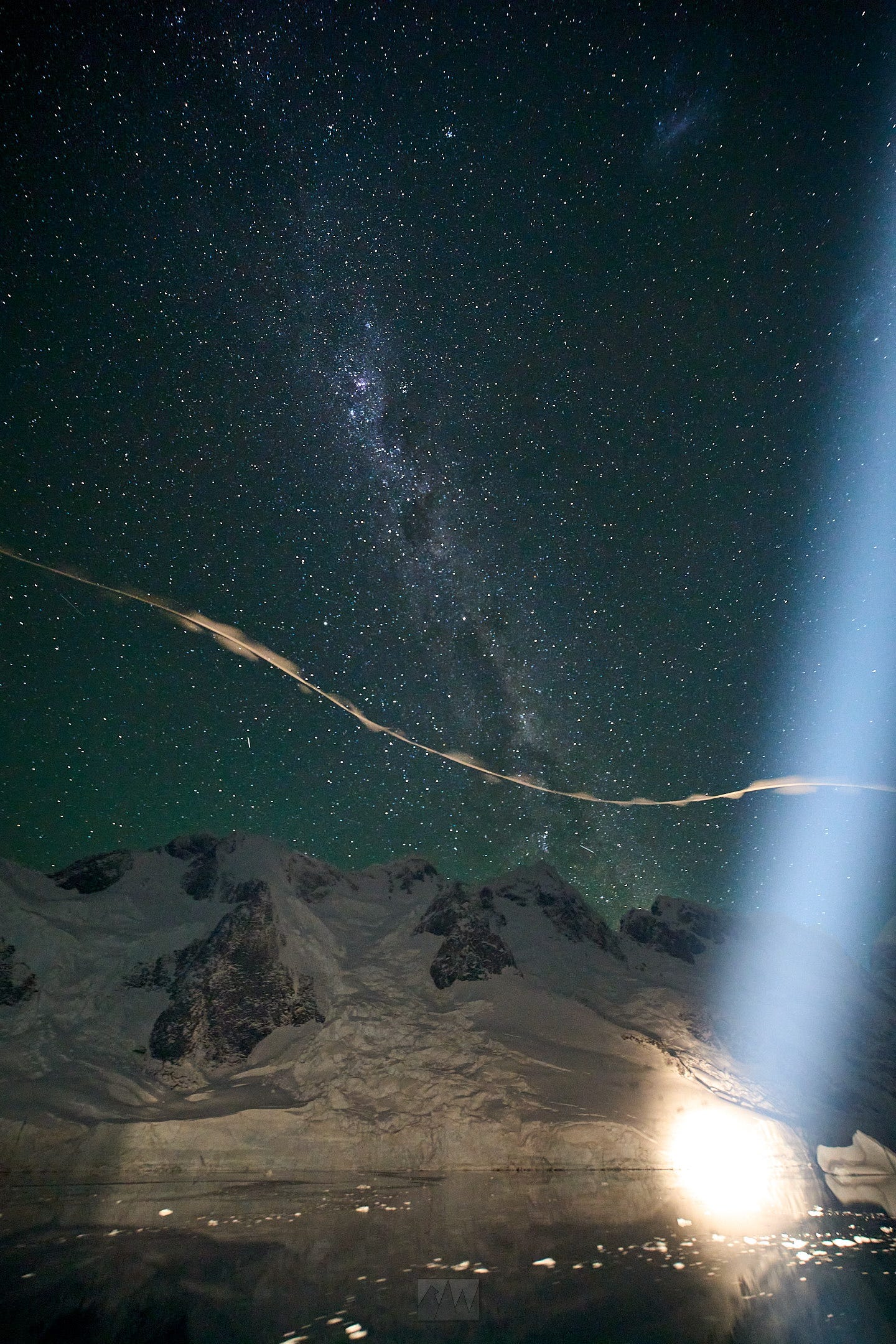
Upon returning to the ship, I checked my forecast to discover that we’d have clear skies, and a Kp index of 6.
This could only mean one thing - Aurora Australis.
To put the significance of this into perspective, in the Northern Hemisphere, Aurora Borealis faces north towards the pole. The Milky Way, however, points south. In the southern hemisphere, where all of Antarctica lies, Aurora Australis points south towards the pole in conjunction with the Milky Way. The auroral oval (regions of the earth that are likely to see auroras) in the North is densely occupied by many countries like Norway, Iceland, Greenland etc, but in the South, pretty much only Antarctica, and some remote sub-Antarctic islands are within that region.
This means that, barring an unbelievably large geomagnetic storm, seeing the Milky Way AND Aurora together in the same direction is something that’s possible only in Antarctica. (You can see both along the coasts of Tasmania/New Zealand, but it still takes a decently large storm for it to happen).
Nevertheless, with how fast conditions change and how meaningless weather predictions are in Antarctica, we could only hope.
Dinner.
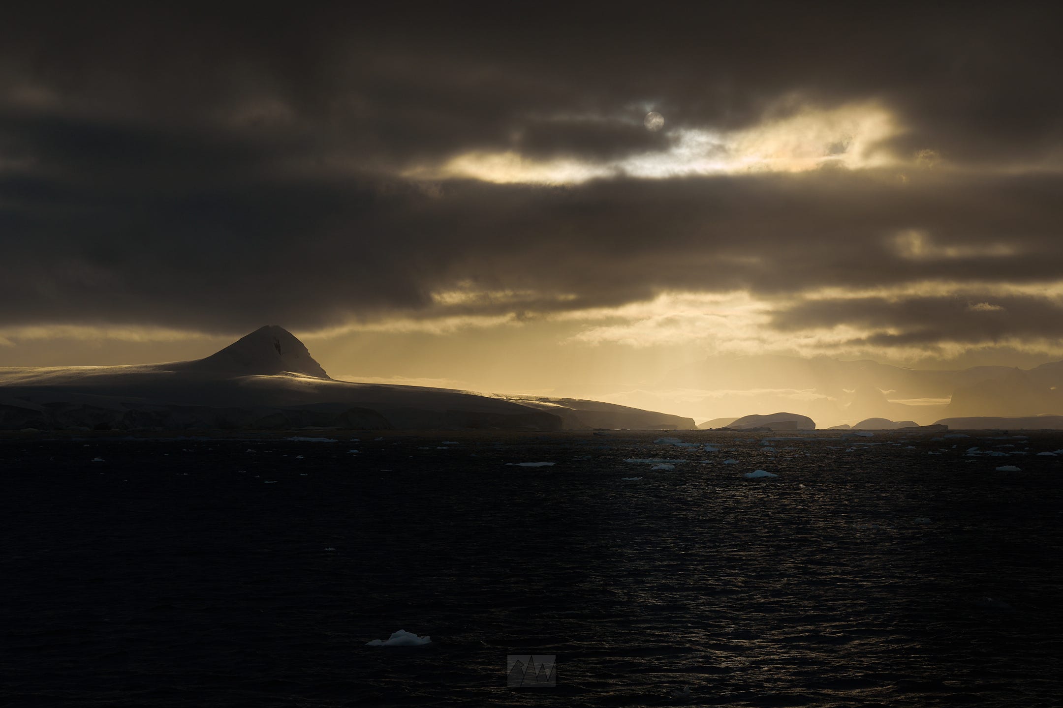
2030hrs. As the sun sets, the overcast skies of Antarctica finally reveals itself, showing off the magic of a dark sky, untouched by light pollution for thousands of miles. More stars than I’d ever, and will ever see, in my entire life. Despite having been to some very remote places, I’ve never been this far from civilization and thus light pollution.
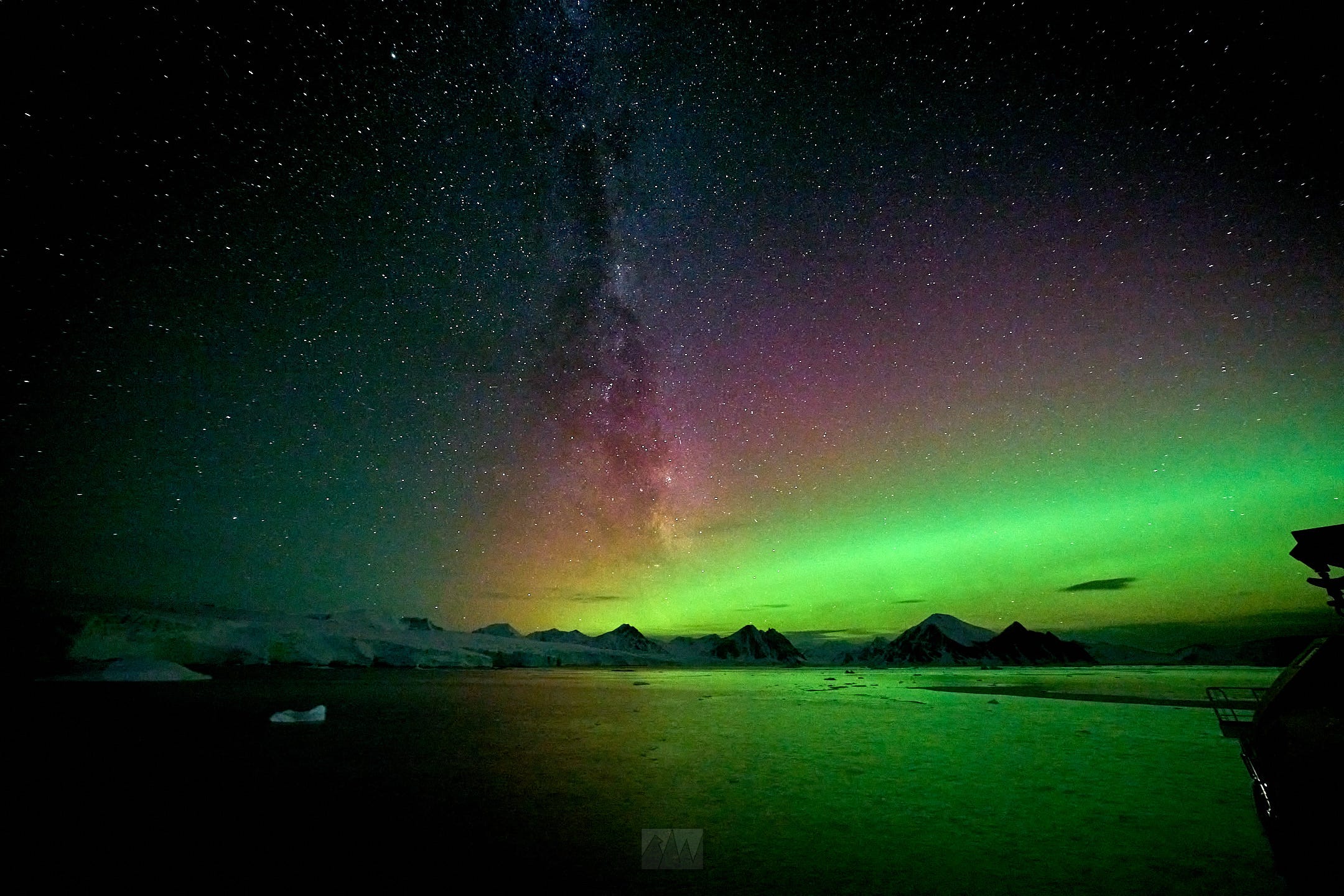
Along with the stars came a faint glow of green - a sign that we needed to drop anchor as soon as possible. As we sailed, the green only grew in intensity, finally dropping anchor at 2130, in Marguerite Bay.
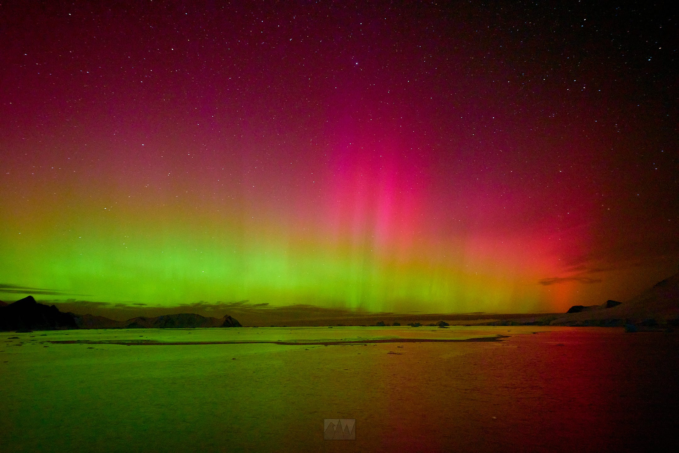
2230 - the aurora peaked with the most spectacular scene of my lifetime. I don’t think anything in the world can top this.
Mar 26:
Marguerite Bay, Stonington Island, Red Rock Ridge. High of 1c, low of -10c, rough seas, 20+kt winds.
After an unbelievable night, came an unbelievable morning. As the sun rose, the clouds came back in and lit up the skies with such intensity, I simply couldn’t comprehend.

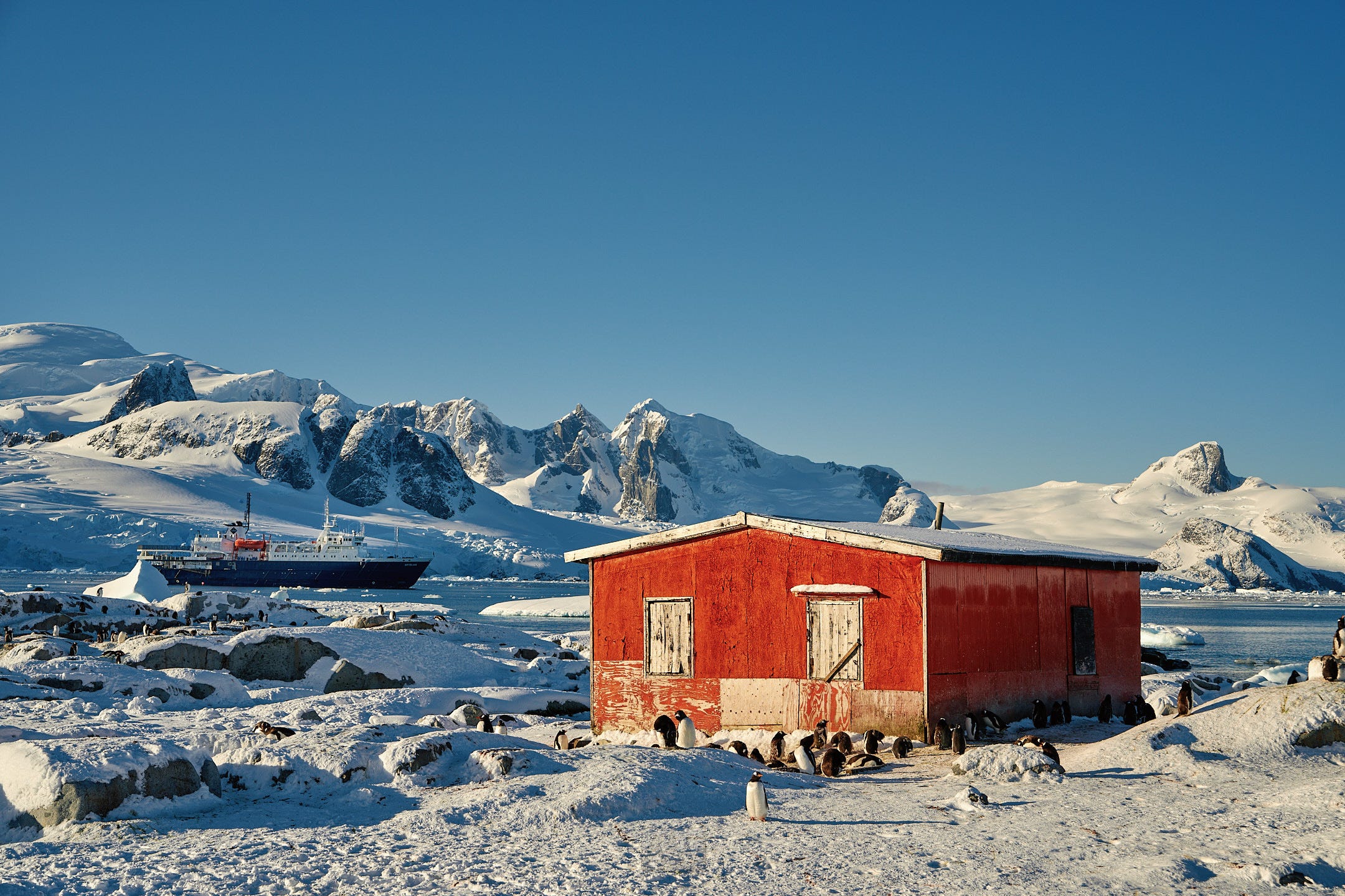
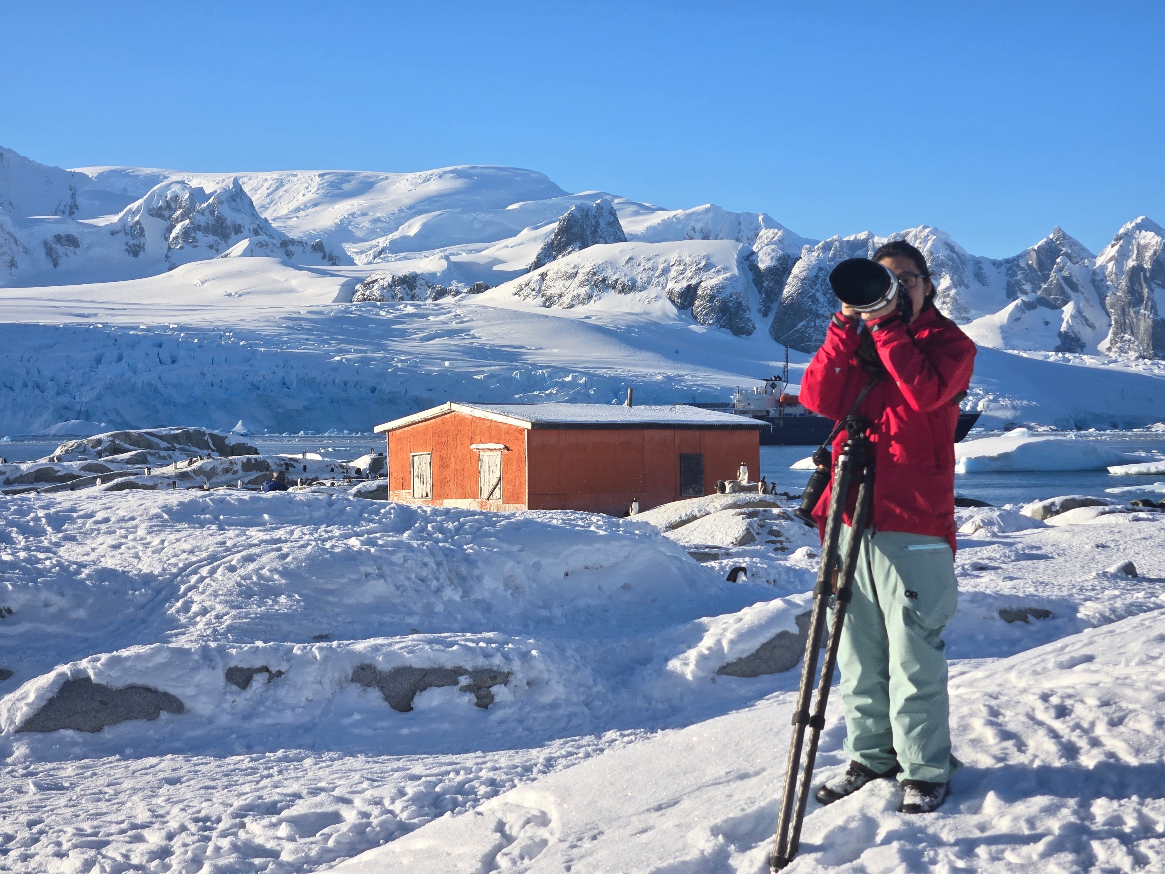
Breakfast, then a landing on Stonington Island, home to two research bases - Base E (UK) and East Base (US).

East base, the oldest American research station in Antarctica, was the site of the US Antarctic Service Expedition (1939) and the Ronne Antarctic Research Expedition (1947). The Ronne Antarctic Research Expedition is particularly notable in that Edith Jackie Ronne and Jennie Darlington became the first two women to overwinter in Antarctica, with Edith Ronne being the first American woman to step foot on the continent. The Ronne Ice Shelf is named after Edith. Edith worked as the expedition’s historian, writing news releases and recording the daily history of the expedition’s accomplishments.
The UK Base/Station E served much the same purpose as the American East Base, acting as a research hub as well as an access point to the interior of the continent. Nearby the base was a runway, from which planes would deposit supplies held at the various bases.
On Stonington Island, we encountered tons of Antarctic shags, skuas, Adelies, fur seals, and crab eater seals.
Lunch, then we sailed south to Hadley Upland for our second landing of the day, on Red Rock Ridge.
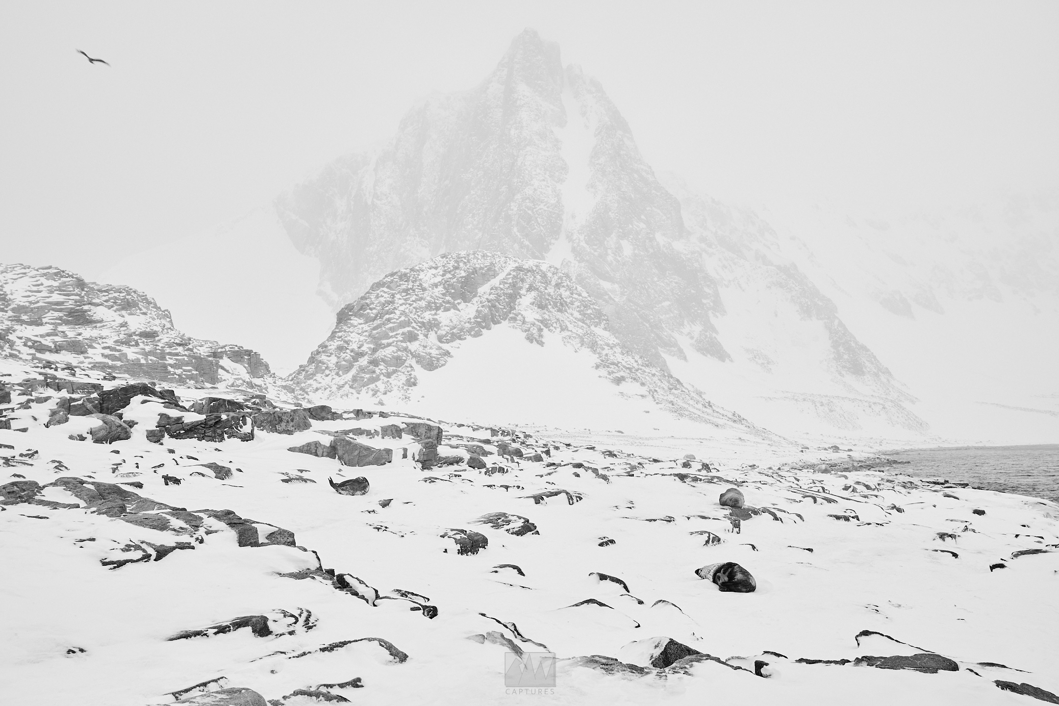
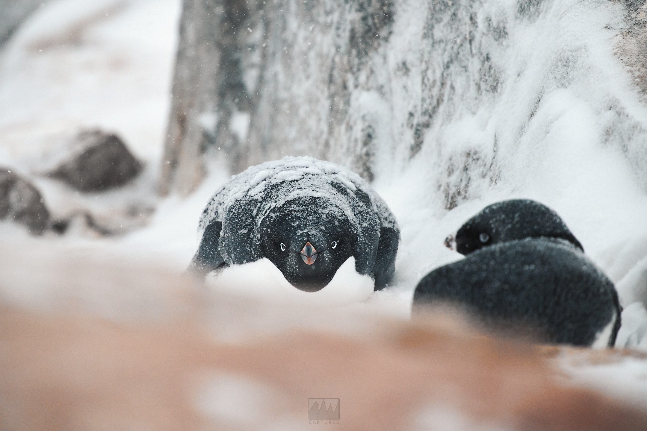
Weather really picked up, but despite the relentless wind, snow, and waves, the island was filled with thousands molting Adelie penguins and fur seals amongst the rocks. With snow drifts blasting across the site, the unbothered Antarctic wildlife showed us just how out of element humans are in conditions like these.
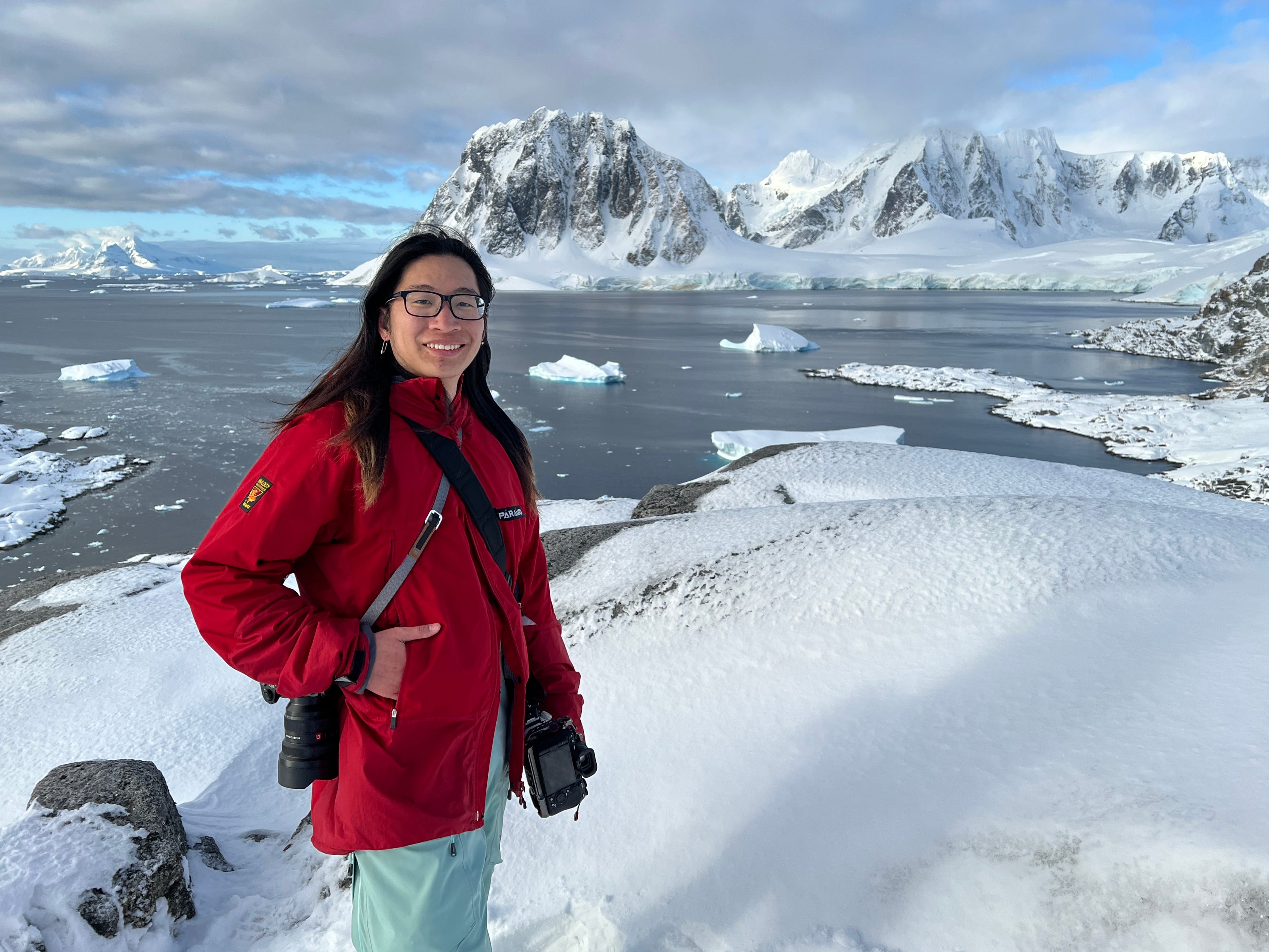
The Zodiac ride back to the ship was a very bumpy and wet one, with me sitting at the front taking the brunt of the splashing on behalf of the other passengers. Luckily, my Paramo rain shell held up just fine.
Mar 27:
Sea day - Lazarev Bay. High of 1c, low of -5c. Calm seas and winds.
After getting a small taste of the “real” Antarctica, we pushed on south, attempting to reach the Wilkins Ice Shelf.
Breakfast, presentations, lunch, presentations, dinner. I spent the entire time out on deck, though there wasn’t much to see as the fog had rolled in thick and was here to stay. Not much happened today, but as always, there were a few intermittent sightings of whales, seals, and penguins between the clouds and fog.
0100hrs - we spotted our first emperor penguin, resting on an ice floe with a crab eater seal resting nearby. The two were unfazed by our ship.
CHAPTER 3: Returning North
Mar 28:
Wilkins Ice Shelf, Wilkins Sound. High of -1c, low of -10c.
Visibility was a little better today, but still quire obscured. Nevertheless, as we departed the ice field in Lazarev Bay, we finally made it to our southernmost point, -70.5S, -72.5W.
At this point, we were by far and away the southernmost passenger ship in the entire world. We were over 700km away from the closest ship, another Oceanwide vessel that was exploring the northern tip of the peninsula, nearly 2,000km away from Ushuaia, the southernmost city in the world.
It would take a minimum of 6 days of nonstop sailing to get back to land (and the closest hospital) from this point.
We had already been the southernmost passenger ship in the entire world since starting our expedition. In late March, nearly all companies stop operations in Antarctica as the incoming winter brings with it sea ice and ice bergs, making safe passage a huge concern for less experienced captains and crews. Luckily, a lack of skill and experience was never a concern aboard Ortelius, so south we went.
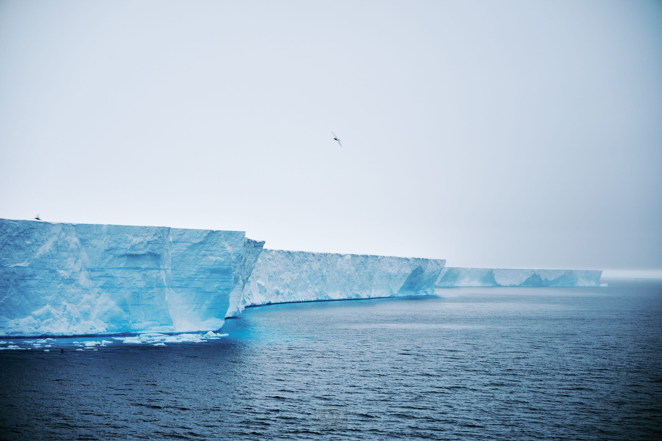
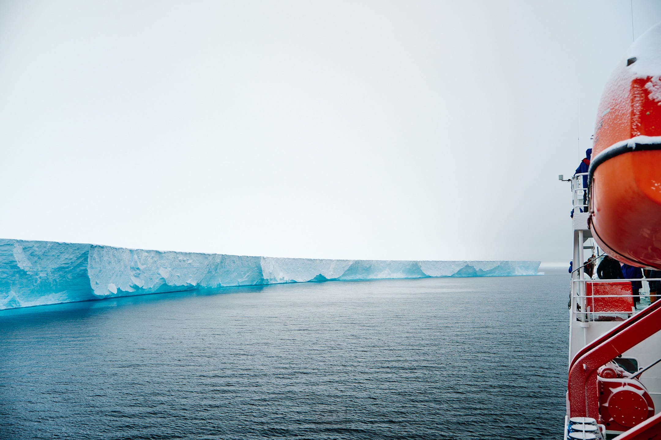
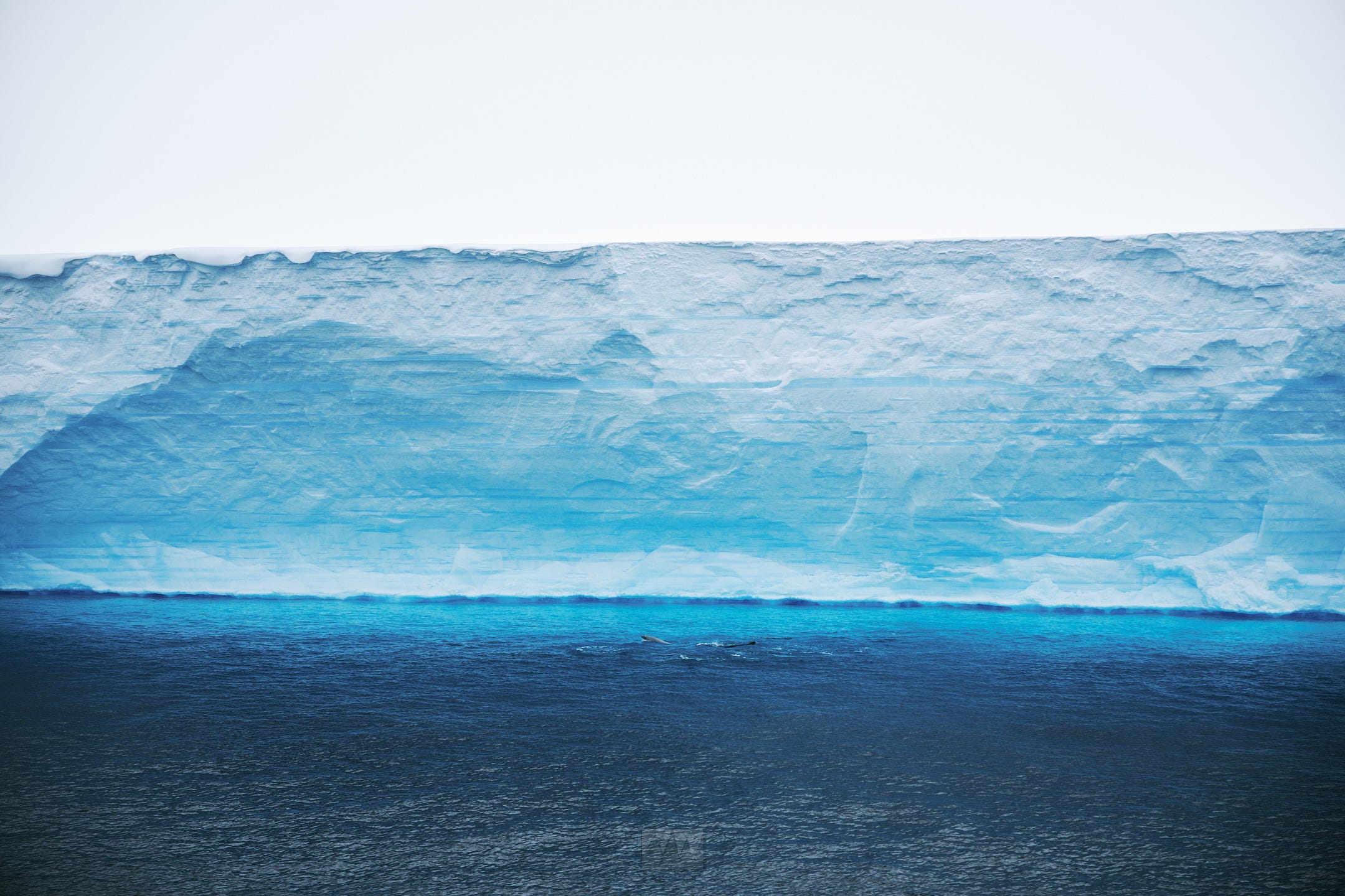
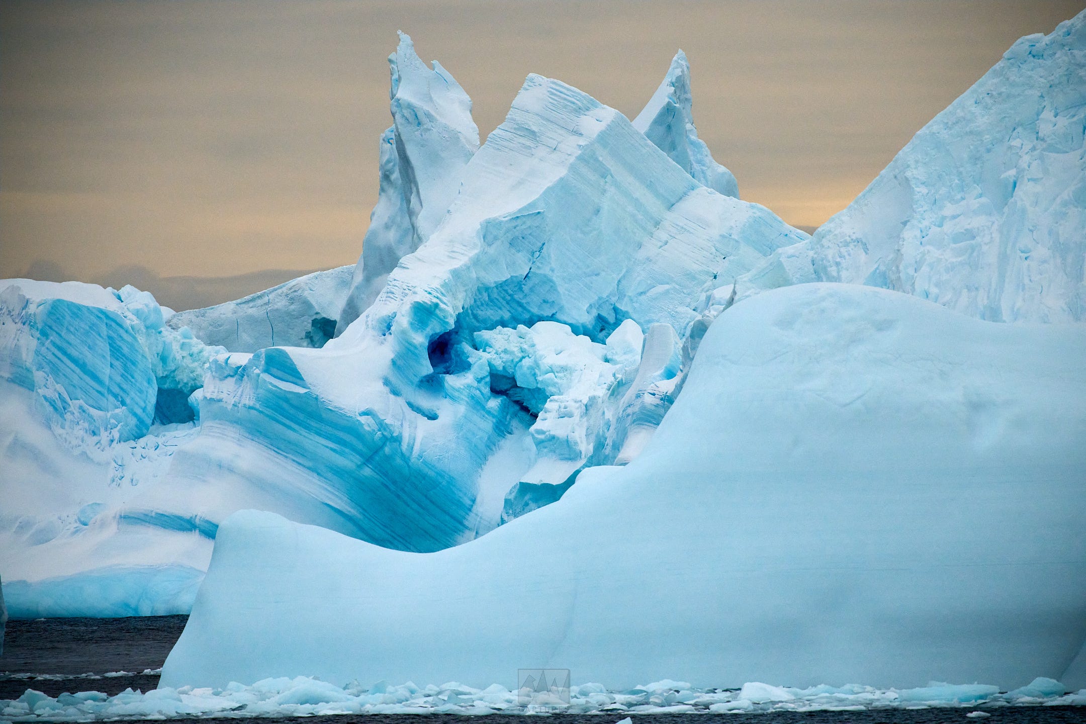
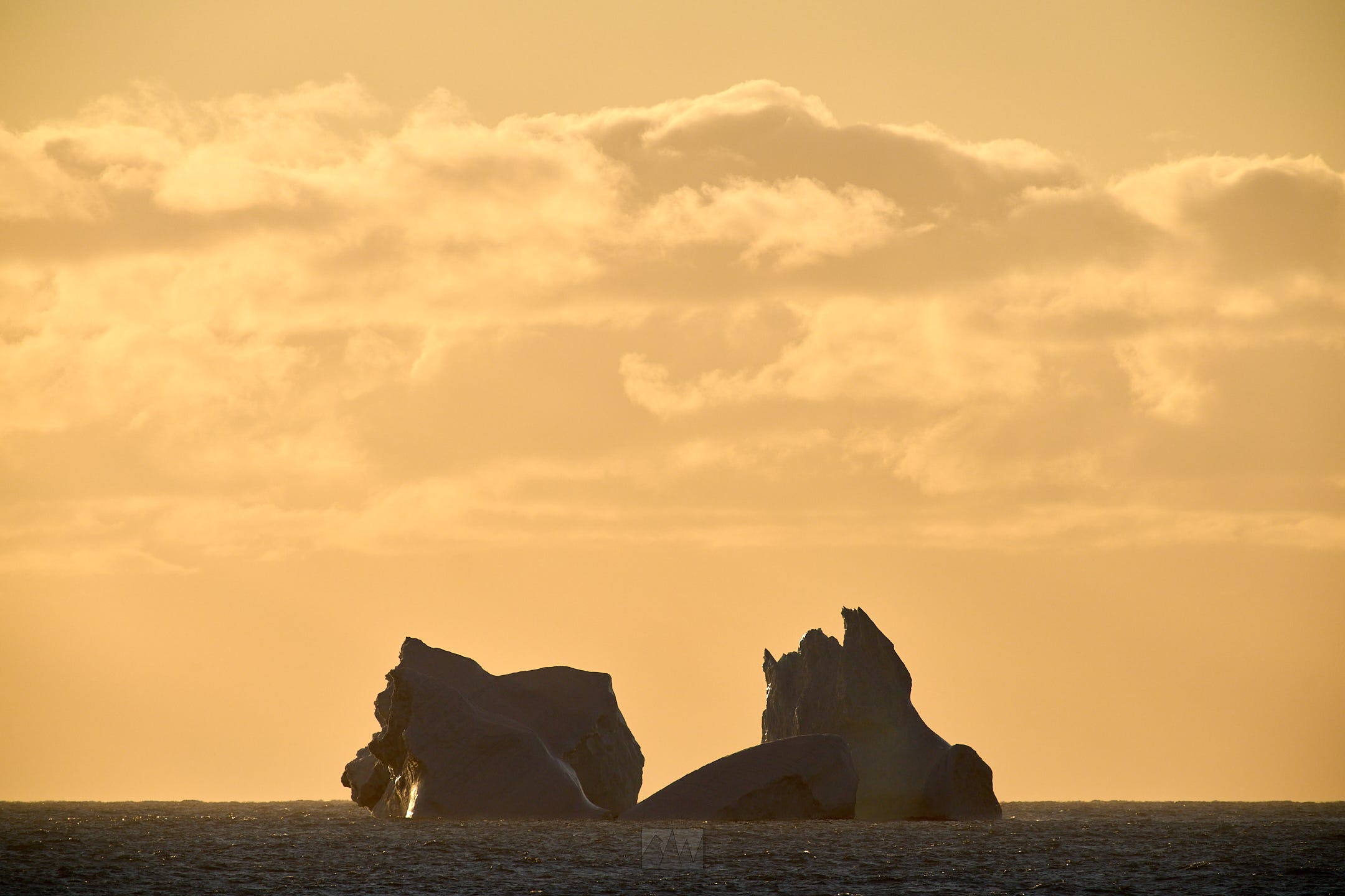
The Wilkins Ice Shelf was unbelievably large, about 150km long, 110km wide, and around 200m tall. The Wilkins Ice Shelf, along with most other ice shelves on the Antarctic peninsula, are facing rapid disintegration due to global warming. In part, it’s the reason why there are so many icebergs in Lazarev Bay. While the endless number of bergs were unbelievably beautiful, it’s a constant reminder that they should really be a part of the ice shelf rather than broken apart and floating around at sea.

At the ice shelf, we spotted many crab eater seals swimming playing, and resting on ice floes along the shelf.
Lunch.
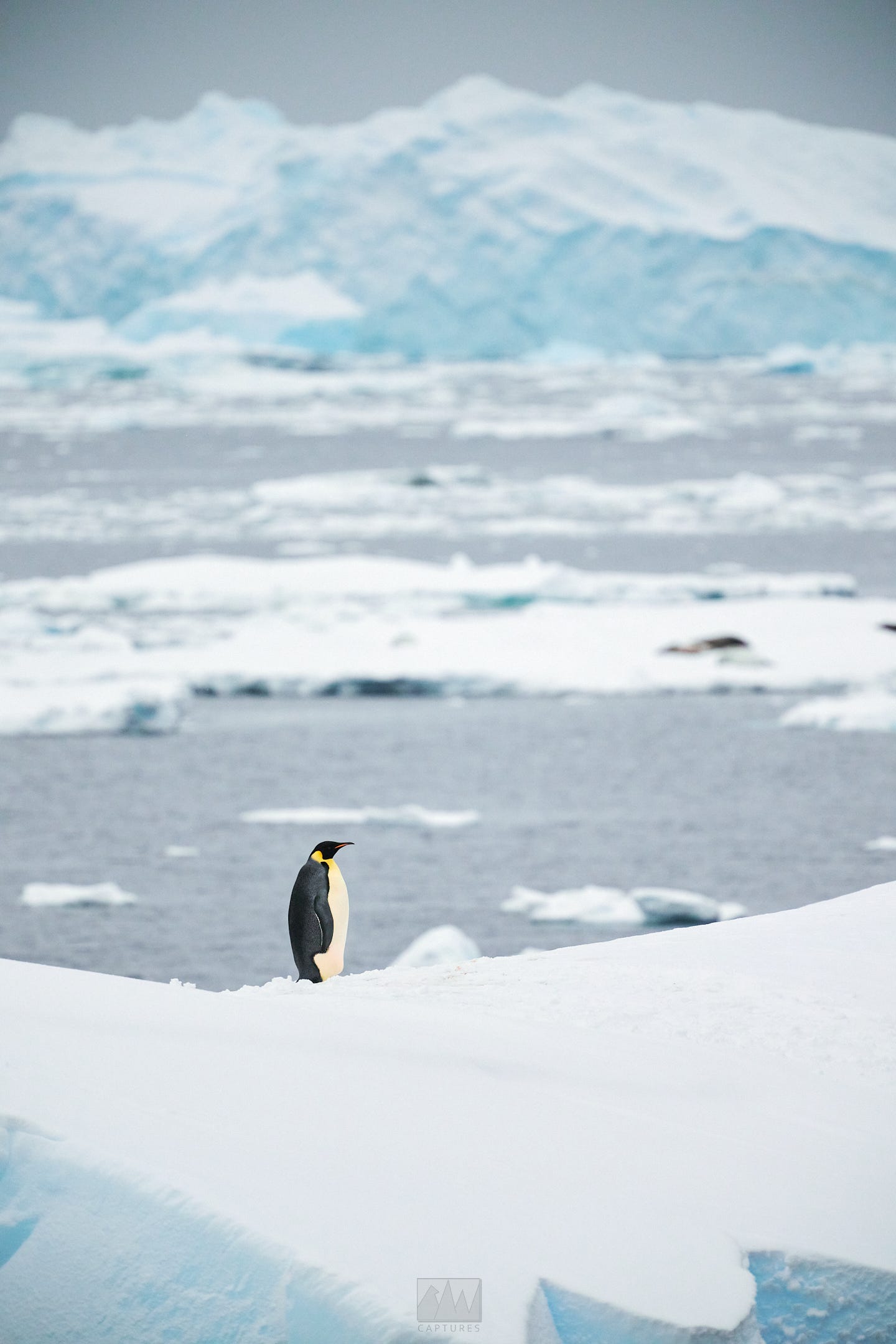
After our encounter with the Wilkins Ice Shelf and hitting our southernmost point, we turned back to head north, navigating through Wilkins Sound for an incredible Zodiac cruise through the bergs. Wildlife was abundant, with several Minke whale encounters, as well as leopard, Weddell, crab eater seals, an Emperor penguins.
Dinner.
The ship momentarily lost power at 2330hrs. I was having a drink and chatting with some passengers in the lounge when it happened. Shortly after, the power came back on.
Mar 29:
Lazarev Bay. High of -5c, low of -10c. Calm seas, low winds.
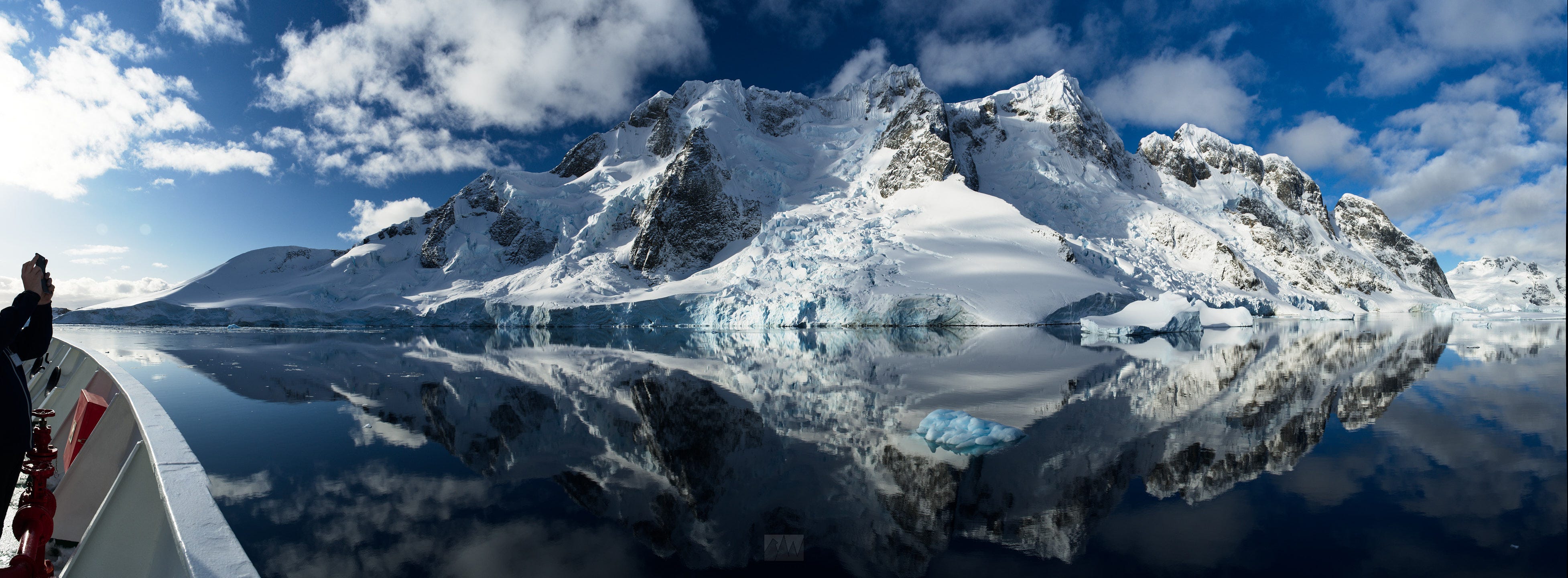
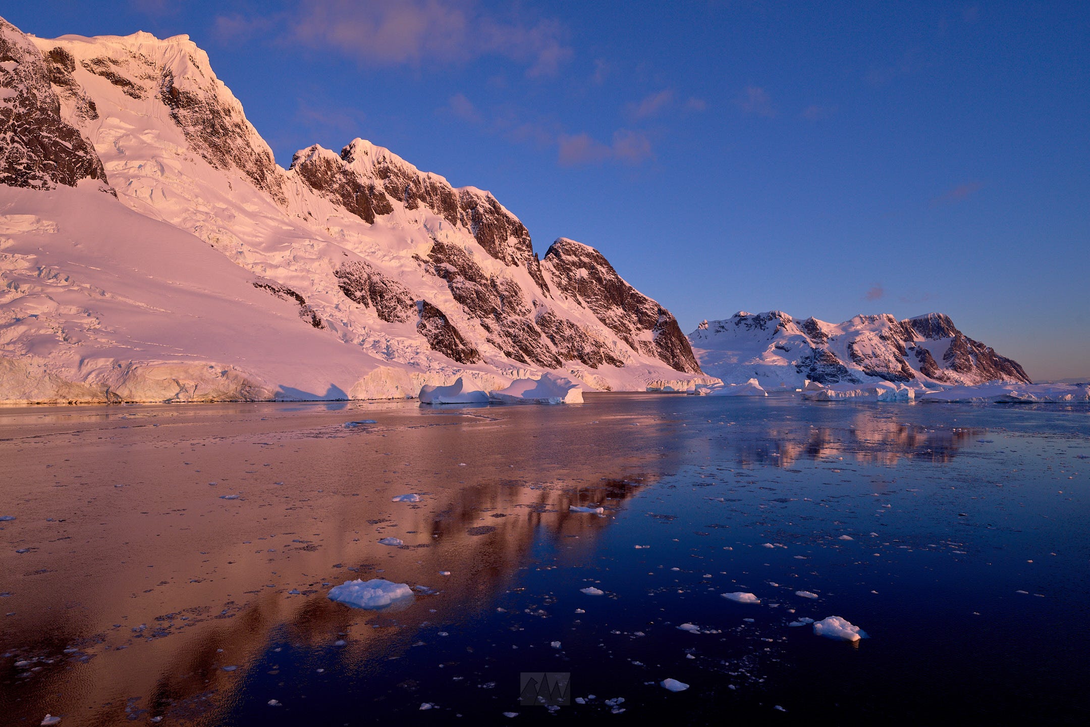
I didn’t think this trip could get any better, but a close second to the Aurora experience was sailing through Lazarev Bay. With the fog slightly lifted, we enjoyed incredible views of the bay that were obscured on our way in. Weather was so good, we abandoned our initial plan to sail north and hung around the area for the day.
We spent the morning sailing towards the heart of Lazarev Bay, encountering many humpbacks and seals on ice along the way.
Lunch.
After lunch, we hopped back onto the Zodiacs to explore this icy wonderland, where we again met with more humpbacks, minke whales, leopard seals, crab eater seals, and emperor penguins.

Dinner, and an early night for me.
Mar 30:
Lazarev Bay. High of -2c, low of -15c. Calm seas, no winds.
Breakfast.
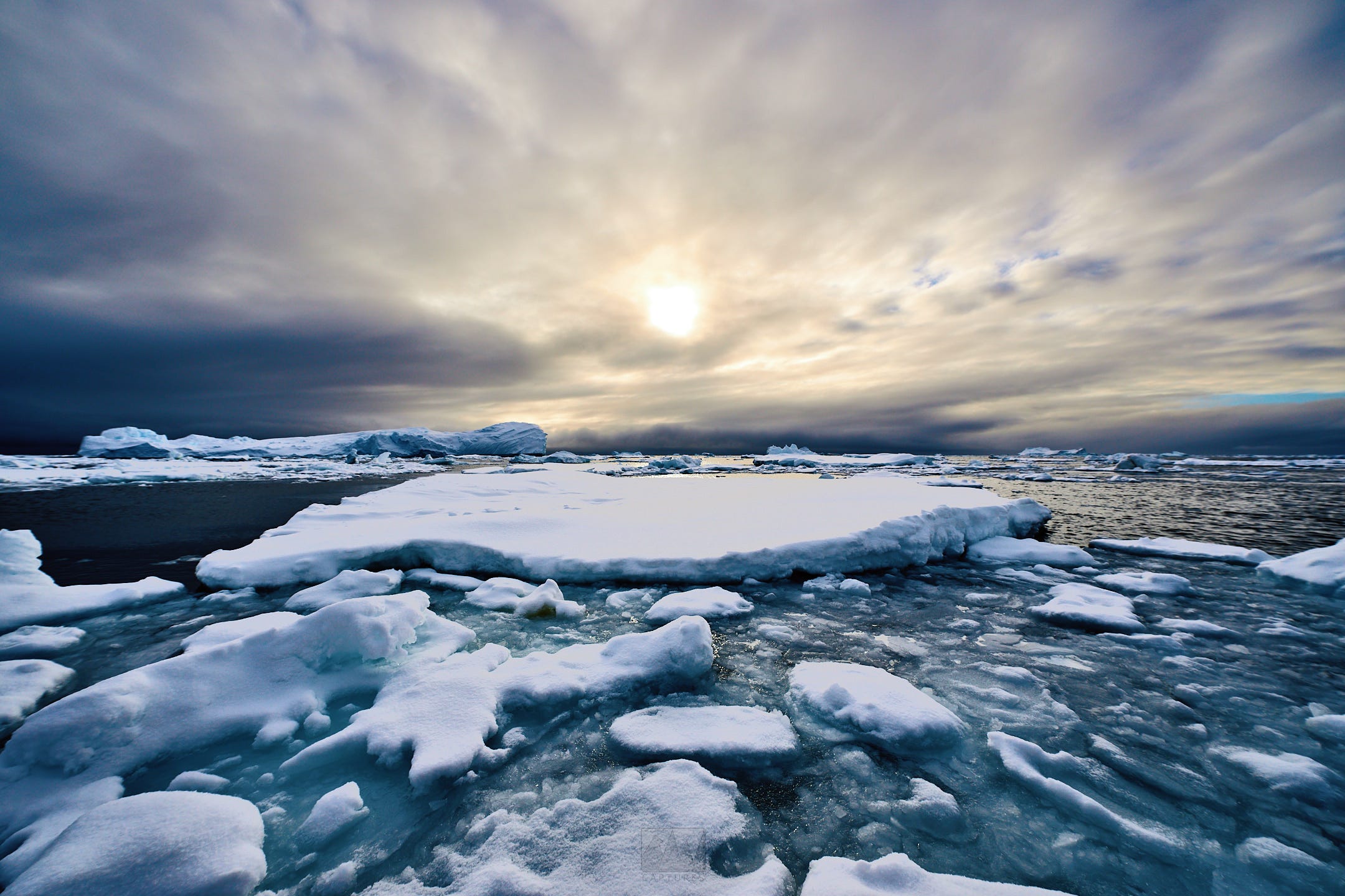
We spent another day in Lazarev Bay. This morning, the fog rolled back in which created some incredible atmosphere as massive, towering icebergs would appear and disappear through the scene. We had an extremely close encounter with a leopard seal and a humpback while out on the zodiacs, and as the sun rose higher in the sky, the fog disappeared and yet again, we were treated to an insane view of Lazarev Bay while heading back to the ship.
Lunch, sailing back north.
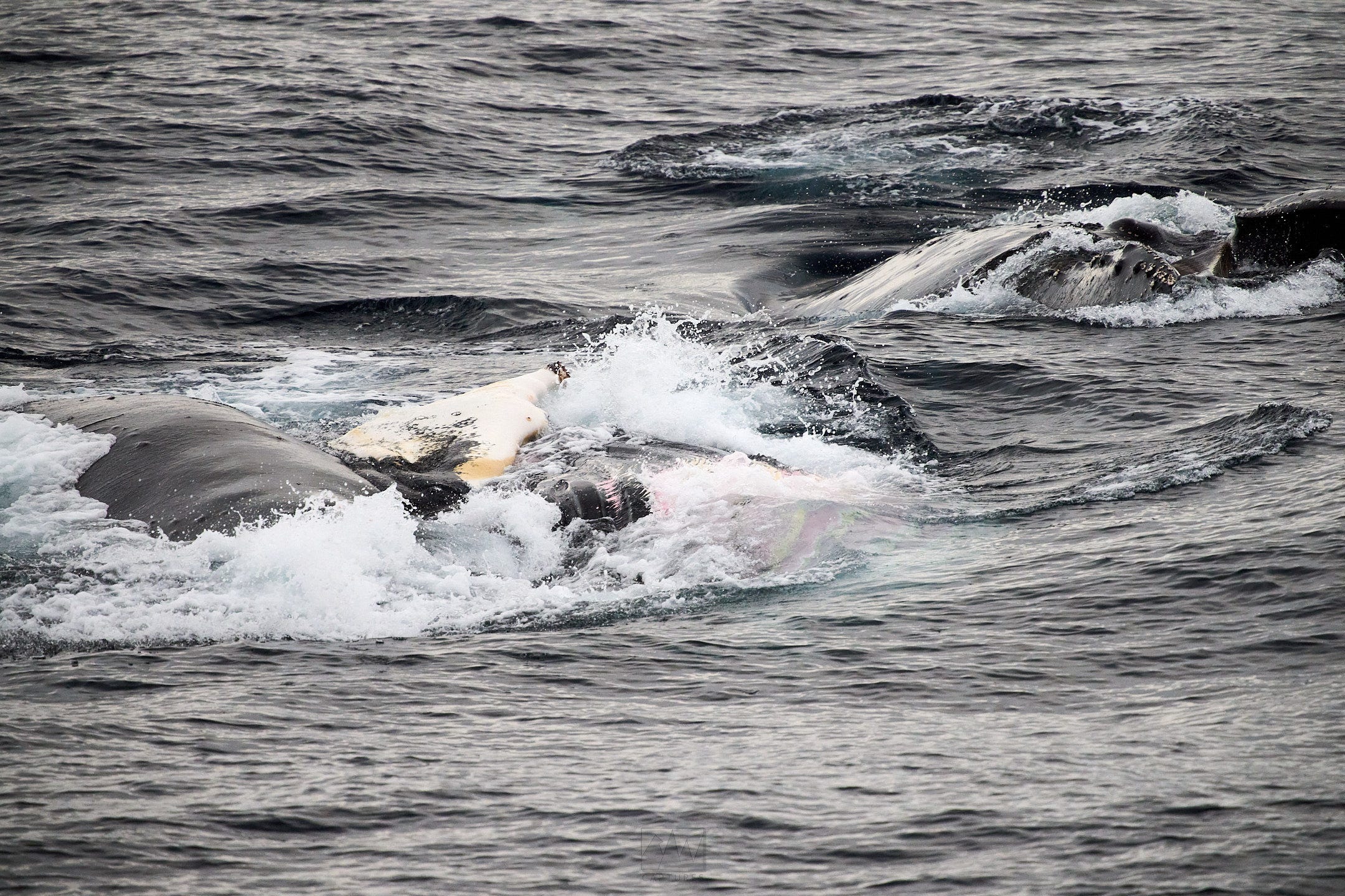
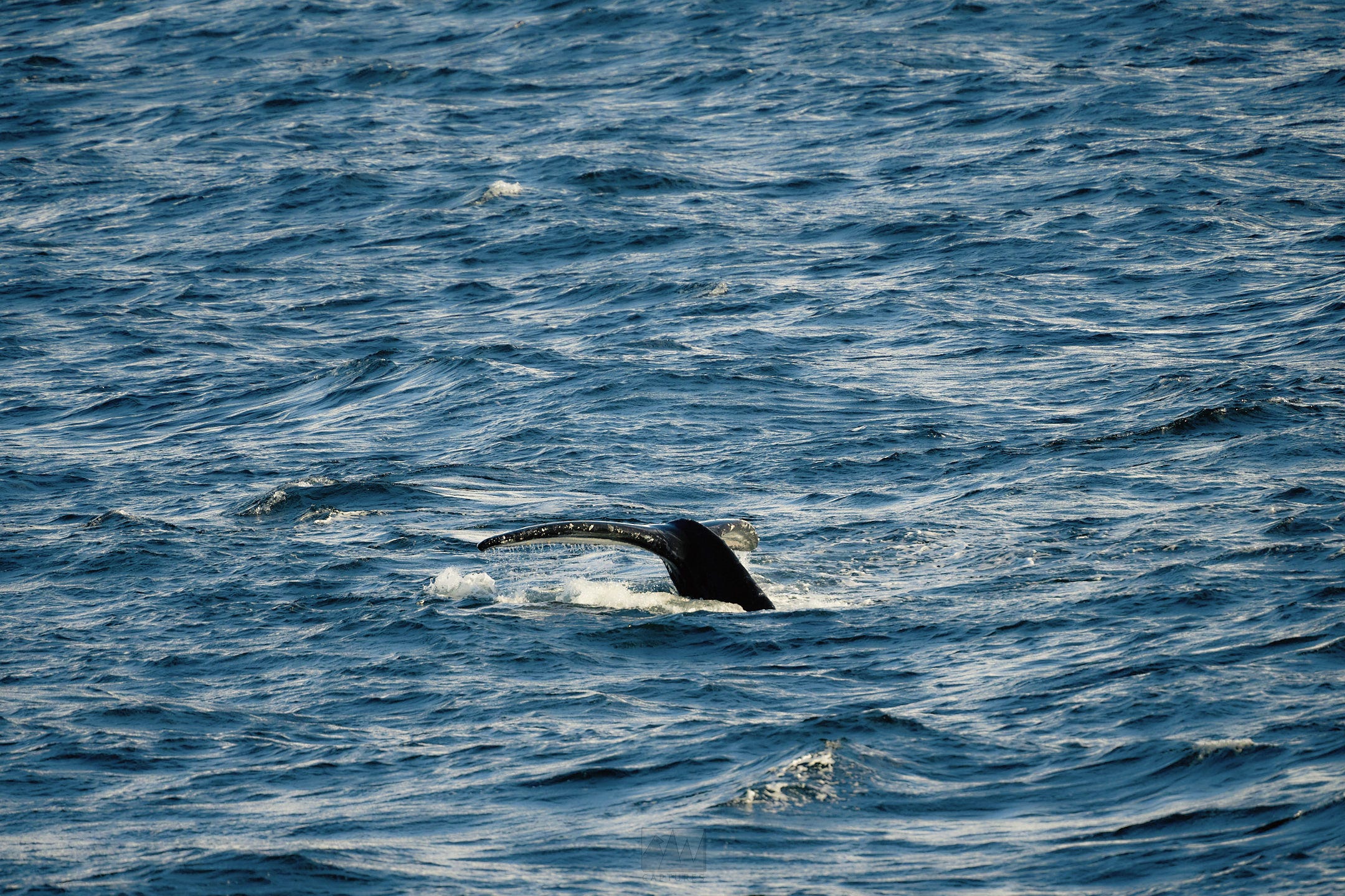
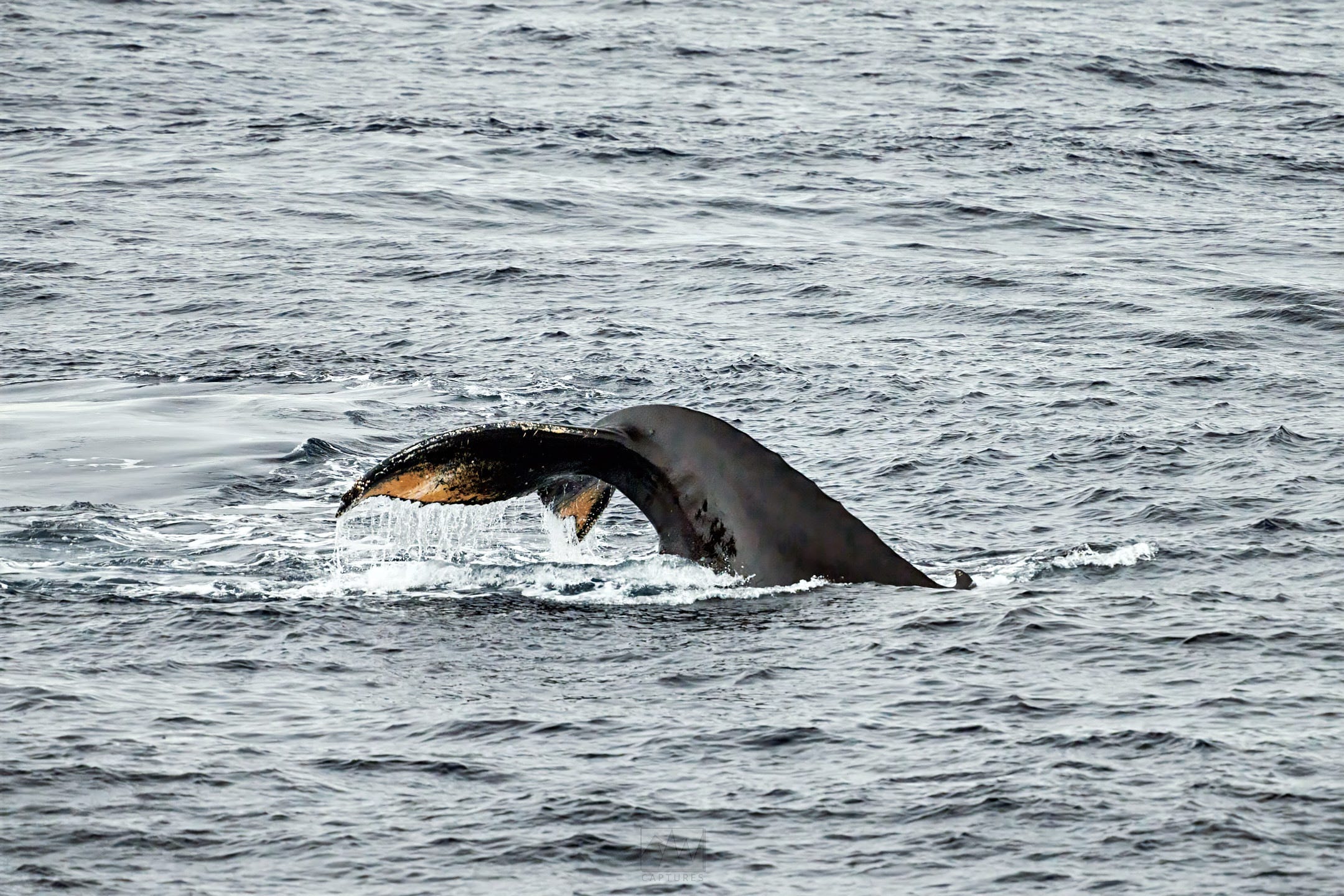
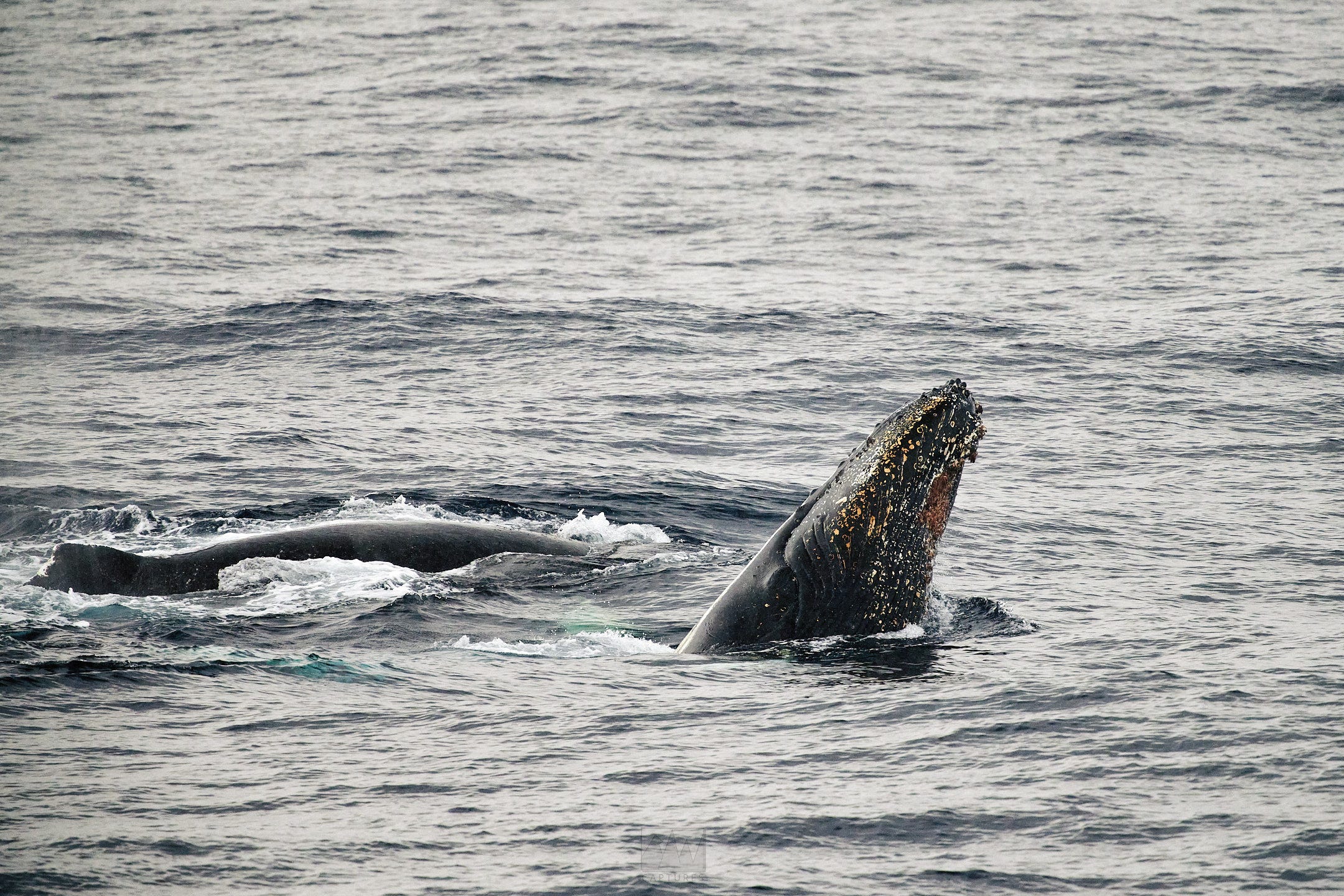
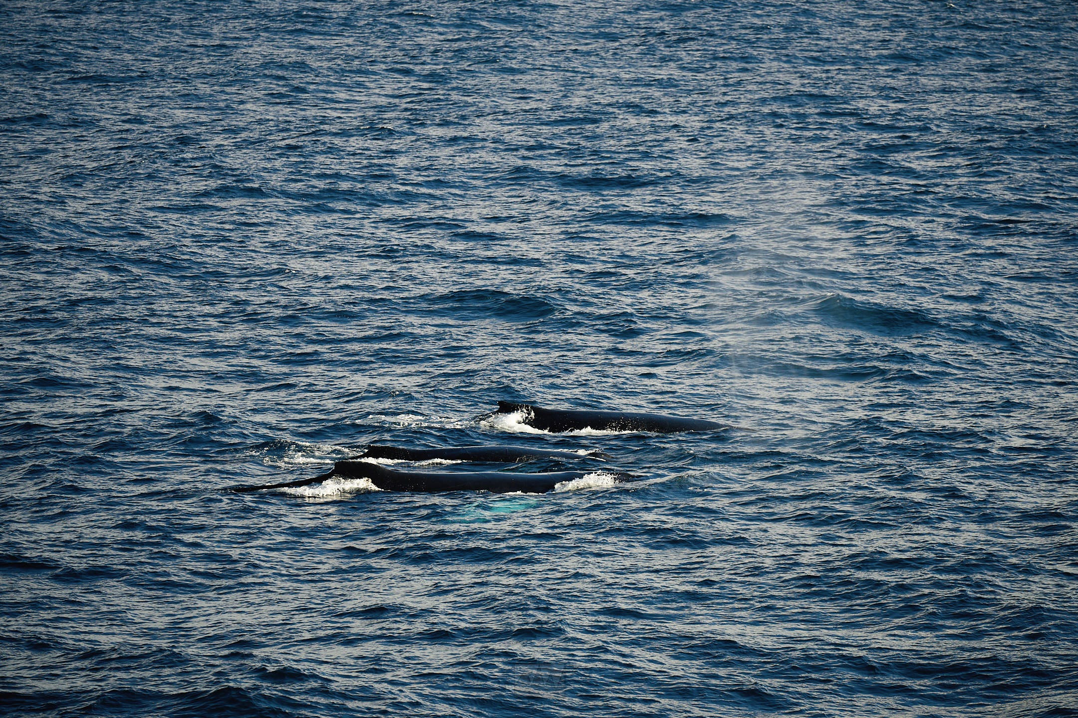
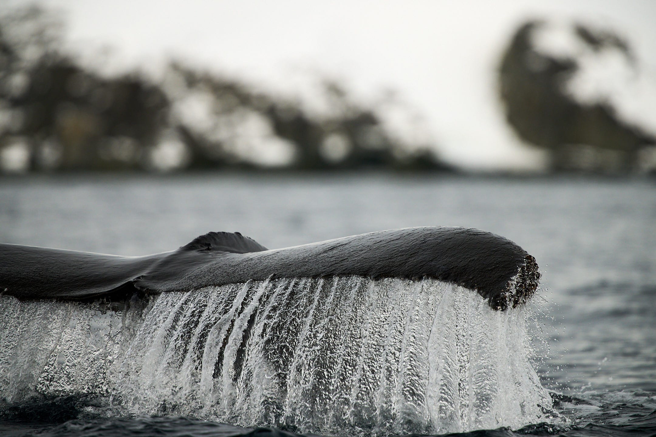
We got some insane light throughout the day, perfect for the incredible amount of icebergs we encountered. While out at open sea, we came across a MASSIVE group of humpback whales feeding on what must have been an even more massive school of krill. They were lunge feeding, with even a few breaching! In every direction, surrounding the ship, was at least 3-5 whales feeding. Standing on top deck, you could see them bubble net feeding, creating massive air bubbles and scaring the krill into a nice big ball for them to chomp on.
Mar 31:
At sea, Wilhelm Archipelago. High of -1c, low of -5c. Slightly rough seas, mild winds.
Breakfast, presentations, lunch, presentations, dinner. As usual, I spent all day out on deck. We saw what was most likely a blue whale way out in the distance, and encountered even more humpbacks feeding, though not the insane show it was yesterday. Checking the forecast, we had a Kp of 2 and clear skies, so the possibility of a second aurora was decent.
The whales were at quite a distance, so it was a little tougher to grab any decent images of them.
Unfortunately, the aurora never came, but the night sky sure did.
Apr 1:
Petermann Island. High of 3c, low of -2c. Calm seas, calm winds.
We had breakfast, then landed on Petermann Island. I still think it’s insane to say, but Petermann Island is a place I’ve been to in the past. Though, not so distant. As we were well into the northern half of the peninsula, many of the sites in the area are ones that most expeditions would target. Petermann is one of such sites, one I’d visited on my first expedition less than 6 months ago.
The island was home to several smaller huts used in past expeditions, but has since been abandoned. Now, it’s home to a single Argentinian emergency shelter, a few graves for past explorers, and thousands of Gentoo penguins. To have visited a place in Antarctica twice is already unique enough, but what made this more special was getting to experience it in a different season. Now, firmly the start of winter, the landscape looked remarkably different to how it did in the summer, 6 months ago.
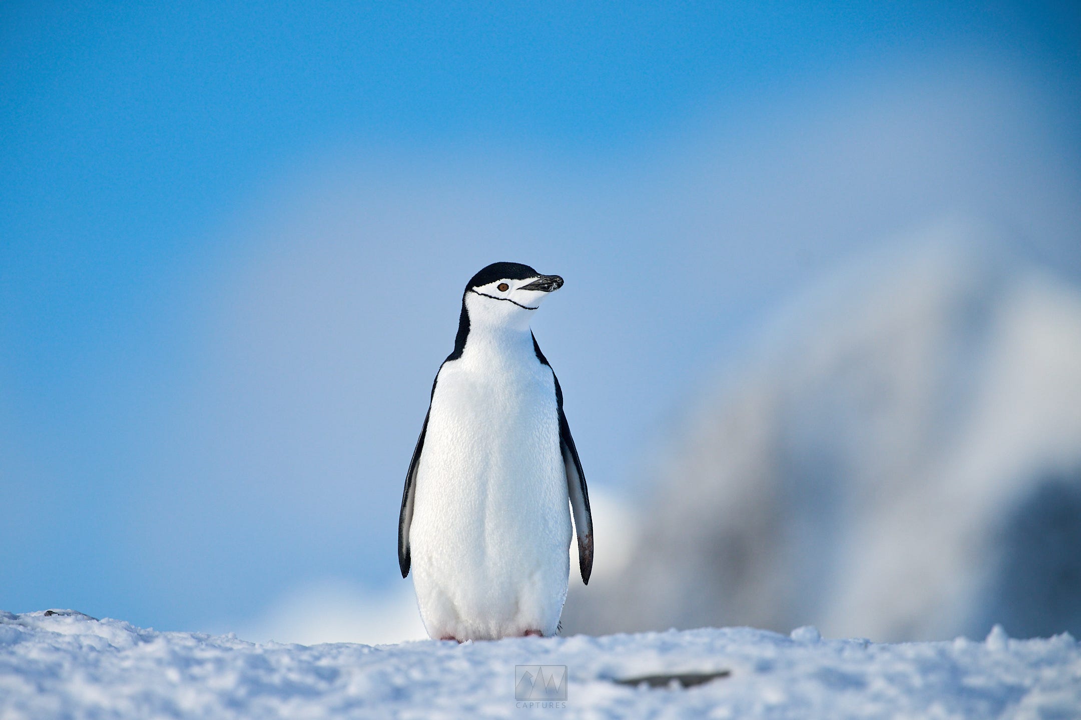
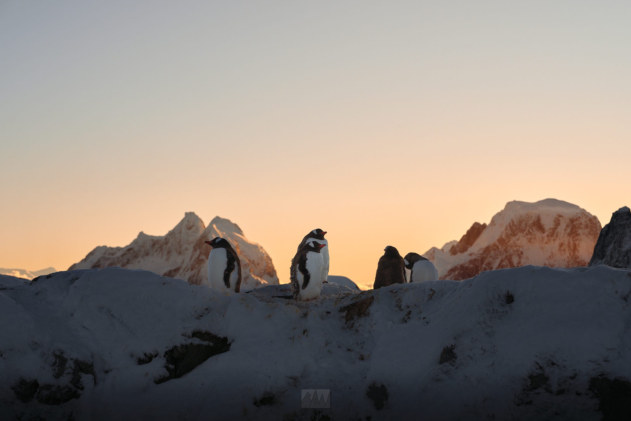
Here, I saw my first chinstrap penguin! There were two of them, one was shy and hiding between the Gentoos, while the other ran around, causing havoc through the Gentoo colonies. It’s suspected that they’re the last of their colony to complete their molt before heading back to sea and back north for the winter.
Lunch, presentation, sailing back north.
Unfortunately, this time, we didn’t sail through the Lemaire Channel. Ice charts showed that it was obstructed with ice, making passage unsafe, so we had to sail on the other side of it. The Lemaire was one of the major highlights of my previous trip, so I was a little bummed. Thankfully for me, the other side of the Lemaire was just as insane.
Tonight’s dinner was a little different - we had a BBQ out on the helideck, surrounded by mountains, glaciers, icebergs, the setting sun, and a clear sky. Somewhere along the lines, free drinks and speaker appeared, so the whole ship got dancing as the sun set in Antarctica. Unbelievable.
Before I got too drunk, I grabbed my camera, tripod, and ran to the bow of the ship, leaving my camera to do a timelapse while I downed more free alcohol.
Apr 2:
Danco Island, Melchior Islands. High of 5c, low of -3c. Slightly rough seas, mild winds
Charted by Gerlache during the Belgian Antarctic Expedition (1897), Danco Island was home to the British research station, Station O, which has since been removed.
We encountered a massive Gentoo colony, after completing their molt, heading back out to sea in the hundreds. We also had our first elephant seal encounter, a young male resting by the beach. It was here that we would do the polar plunge, as is customary when visiting Earth’s polar regions.
After lunch, we had a short sail to the Melchior Islands, home to the Argentine run Melchior base - the world’s first and oldest permanent settlement in Antarctica. It’s an active research base, though it operates only for a few weeks in the summer.
Here, we dropped Zodiacs and sailed through the nearby islands, getting up close to more humpbacks as they fed in the nearby bay. Several of them breached, and as we turned our engines off, some would even come right up to our Zodiacs or even swim directly under it.
CHAPTER 4: The Drake Shake
Apr 3:
The Drake, day 1. High of 5c, low of -3c, 6-7m swell, and strong winds.
From the Melchior Islands, we said goodbye to Antarctica and sailed back north, crossing the Drake once again on our way back to Ushuaia. The next few days were much of the same: breakfast, presentations, lunch, presentations, dinner, hang out at the bar, and of course, hanging out on deck every second possible. By now, all passengers were friends, trading and sharing photos, as well as contact information.
While we enjoyed a relatively “calm” Drake passage on our way in, at *just* 4m tall swells, the swells this time were closer to 6-7m, really throwing the ship and everything aboard back and forth. It was rough enough that all our portholes had to be closed, just in case the waves broke the glass.
Apr 4:
The Drake, day 2. High of 4c, low of -1c. 3-4m swells, mild winds

Much of the same as yesterday, but the swells calmed down to 3-4m, a lot more appreciated than yesterday’s conditions. While I was still unaffected, it was still a struggle walking and keeping things from falling aboard the ship.
We arrived in the safety of the Beagle channel near midnight, putting an end to the unrelenting rocking.
Apr 5:
Ushuaia, Disembarkation day.
0800hrs.

We wake up for our last breakfast on board. In between packing, exchanging contact info, and inhaling breakfast, it was time to disembark. We scanned our keycards for the last time, and finally stood back on solid ground for the first time in what felt like years.
I spent the day recounting the experience with other fellow passengers, figuring out my return flight, before finally securing it and running off to the airport later that same evening.
CHAPTER 5: HOME
I can’t describe what it’s like to visit Antarctica. Visitation itself is a whole other issue, one I’ll probably save for another post as this one is already long enough.
All I can say is that any notion, expectation, thought, picture, video, or any information you’ve gathered on it - none of it can possibly, even come close to, adequately conveying the experience of the frozen continent.
It’s harsh, relentless, brutal, unforgiving. Yet, it’s by far and away the most beautiful, life-changing, eye-opening experience I’ll ever have. I’m unbelievably thankful to…I guess life, for letting me experience, explore, and document the landscapes and wildlife of Antarctica. I’m thankful to all my friends, old and new ones made on board, for supporting my dreams. I’m thankful for you all, my readers, for giving me a platform to share my love for this world.